Nakapiripirit | |
|---|---|
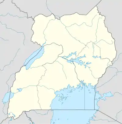
 Nakapiripirit Map of Uganda showing the location of Nakapiripirit. | |
| Coordinates: 01°51′08″N 34°43′17″E / 1.85222°N 34.72139°E | |
| Country | |
| Region | Northern Region of Uganda |
| Sub-region | Karamoja sub-region |
| District | Nakapiripirit District |
| Elevation | 1,450 m (4,760 ft) |
| Population (2014 Census) | |
| • Total | 3,727[1] |
| Time zone | UTC+3 (EAT) |
Nakapiripirit is a town in the Nakapiripirit District of the Northern Region of Uganda. It is the seat of the district headquarters.[2] The town is an administrative unit of the district, at the level of a sub-county; one of the eight sub-counties in the district.[3]
Location
Nakapiripirit is located in Nakapiripirit District, approximately 130 kilometres (81 mi), by road, northeast of Mbale, the nearest large city.[4] This is approximately 94 kilometres (58 mi), by road, south of Moroto Town, the largest urban center in the Karamoja sub-region.[5] Nakapiripirit is about 353 kilometres (219 mi), northeast of Kampala, the capital and largest city of Uganda.[6] The coordinates of Nakapiripirit Town are 01°51'08.0"N 34°43'17.0"E (Latitude:1.852222; Longitude:34.721389).[7] Nakapiripirit town sits at an average elevation of 1,450 metres (4,757 ft) above mean sea level.[8]
Population
The 2002 national population census estimated the population of the town at 1,640. In 2010, the Uganda Bureau of Statistics (UBOS) estimated the mid-year population at 2,600. In 2011, UBOS estimated the population at 2,800.[9] The 2014 population census enumerated the population of the town at 3,727 people.[1]
Points of interest
The following additional points of interest lie in Nakapiripirit or near its borders: (a) offices of Nakapiripirit Town Council (b) Nakapiripirit central market (c) Moroto–Nakapiripirit Road,[10] passes through the middle of town, where it links up with Muyembe–Nakapiripirit Road.[11]
Hill View Resort, located in town and overlooking Mount Kadam, offers accommodation, meals and entertainment.[2] Mount Kadam itself is about 25 kilometres (16 mi), as the crow flies, southwest of Nakapiripirit Town, with an estimated driving distance of about 30 kilometres (19 mi).[12]
See also
References
- 1 2 Uganda Bureau of Statistics (April 2017). "National Population and Housing Census 2014: Area Specific Profiles: Map 3: Distribution of Population by Sub-county; Nakapiripirit District, 2014" (PDF). Kampala: Uganda Bureau of Statistics. p. 9. Retrieved 20 September 2018.
- 1 2 Abdulaziizi K. Tumusiime (1 November 2013). "The place to relax in Nakapiripirit". Daily Monitor. Kampala. Retrieved 20 September 2018.
- ↑ LCMT.Org (20 September 2018). "Subcounties in Nakapiripirit District". LCMT.Org. Retrieved 20 September 2018.
- ↑ Google (13 January 2021). "Road Distance between Mbale, Uganda and Nakapiripirit, Uganda" (Map). Google Maps. Google. Retrieved 13 January 2021.
- ↑ Google. "Road Distance between Nakapiripirit, Uganda and Moroto, Uganda" (Map). Google Maps. Google.
- ↑ Google (13 January 2021). "Distance between Post Office Building, Kampala Road, Kampala, Uganda and Nakapiripirit, Uganda" (Map). Google Maps. Google. Retrieved 13 January 2021.
- ↑ Google (20 September 2018). "Location of Nakapiripirit Town" (Map). Google Maps. Google. Retrieved 20 September 2018.
- ↑ Kara-Tunga Tours (28 September 2022). "Elevation of Nakapiripirit Town, Uganda". Kara-Tunnga.com. Moroto, Uganda. Retrieved 28 September 2022.
- ↑ UBOS. "Estimated Population of Nakapiripirit In 2002, 2010 And 2011" (PDF). Uganda Bureau of Statistics (UBOS). Retrieved 3 June 2014.
- ↑ Wanyama, Olandason (12 November 2013). "Moroto–Nakapiripirit Road Construction Commissioned". Uganda Radio Network. Retrieved 21 July 2015.
- ↑ Nakatudde, Olive (11 March 2015). "Parliament Okays Shs330billion Loan for Nakapiripirit Road". Kampala: Uganda Radio Network. Retrieved 8 January 2016.
- ↑ "Distance between Nakapiripirit, Uganda and Mount Kadam, Uganda". Globefeed.com. 20 September 2018. Retrieved 20 September 2018.
External links
- Water Crisis Hits Nakapiripirit
- Nakapiripirit Gets Power As of 31 August 2010.
