Nawabganj | |
|---|---|
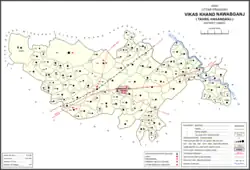 Map of Nawabganj CD block | |
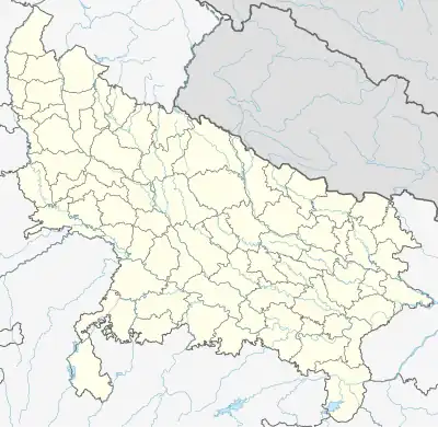 Nawabganj Location in Uttar Pradesh, India | |
| Coordinates: 26°37′16″N 80°40′06″E / 26.6210°N 80.6683°E | |
| Country | |
| State | Uttar Pradesh |
| District | Unnao |
| Established | 1842 |
| Area | |
| • Total | 1.62 km2 (0.63 sq mi) |
| Elevation | 93 m (305 ft) |
| Population (2011)[1] | |
| • Total | 11,545 |
| • Density | 7,100/km2 (18,000/sq mi) |
| Languages | |
| • Official | Hindi |
| Time zone | UTC+5:30 (IST) |
| PIN | 209859 |
| Vehicle registration | UP-35 |
| Website | Npnawabganj.com |
Nawabganj is a town and nagar panchayat in Hasanganj tehsil of Unnao district, Uttar Pradesh, India.[1] It is located northeast of Unnao on the Lucknow-Kanpur road, near the Ajgain railway station.[2] Founded in 1842[2] and first officially classified as a town for the 1981 census,[3] Nawabganj once served as the seat of a tehsil under the Nawabs of Awadh[2] and is today the headquarters of a community development block containing 124 villages.[1]
Nawabganj is the site of Nawabganj Bird Sanctuary, which was established in 1984 at the site of a local lake.[1] Designated as a protected Ramsar site since September 2019, the sanctuary is home to over 25,000 birds (including both resident and migratory populations) across some 220 species.[4] Among the species present are the endangered Egyptian vulture and Pallas's fish eagle, as well as the vulnerable lesser adjutant and woolly-necked stork.[4] Additionally, the sanctuary is home to larger mammals including the golden jackal and the jungle cat.[4]
Nawabganj hosts a large annual fair at the end of Chait in honour of the goddesses Durga Devi and Kusahri Devi.[2] The fair is one of the largest in the district, drawing visitors from Lucknow and Kanpur.[2] The Durga temple is in Nawabganj, while the Kusahri temple is in the neighbouring village of Kusumbhi to the north.[2] Major products manufactured in Nawabganj include fireworks, jaggery, and sweets.[1] As of 2011, the town's population is 11,545, in 1,985 households.[1]
History
Nawabganj was founded in 1842 by Amin-ud-Daulah, the prime minister of Oudh State, who also built a sarai and mosque here.[2] Naubat Rai, the state's treasurer, was responsible for the construction of the tank.[2] Under the Nawabs of Awadh, Nawabganj was the seat of a tehsil and also had a thana, but it declined in importance after the tehsil was relocated and the population shrank as a result: it was 3,123 in 1869, but by 1891 it had fallen to 2,840.[2] The 1901 census recorded a population of 2,789, including a Muslim minority of about one-sixth of the total.[2]
Demographics
| Year | Pop. | ±% |
|---|---|---|
| 1981 | 5,597 | — |
| 1991 | 7,691 | +37.4% |
| 2001 | 9,840 | +27.9% |
| 2011 | 11,545 | +17.3% |
| Source: 2011 Census of India[1] | ||
According to the 2011 census, Nawabganj has a population of 11,545 people, in 1,985 households.[1] The town's sex ratio is 934 females to every 1000 males; 5,968 of Nawabganj's residents are male (51.7%) and 5,577 are female (48.3%).[1] The 0-6 age group makes up about 12.7% of the town's population; among this group, the sex ratio is 964, which is higher than the district urban average of 903.[1] Members of Scheduled Castes make up 23.55% of the town's population and members of Scheduled Tribes make up 1.22%.[1] The proportion of scheduled tribes in Nawabganj is the highest among towns in Unnao district.[1] The town's literacy rate was 70.6% (counting only people age 7 and up); literacy was higher among men and boys (75.2%) than among women and girls (65.6%).[1] The corresponding gap of 17.3% was the highest among towns in the district.[1] The scheduled castes literacy rate is 57.2% (63.5% among men and boys, and 50.7% among women and girls).[1]
In terms of employment, 25.2% of Nawabganj residents were classified as main workers (i.e. people employed for at least 6 months per year) in 2011.[1] Marginal workers (i.e. people employed for less than 6 months per year) made up 3.1%, and the remaining 71.7% were non-workers.[1] Employment status varied substantially according to gender, with 49.8% of men being either main or marginal workers, compared to only 5.3% of women.[1]
Transport
The train station is at the nearby village of Kusambi, 1.5 km[1] north of Nawabganj.[2] There are 7.4 km of roads in the town, and it is connected by bus routes with other towns.[1]
Communications
Nawabganj's PIN code is 209859 and its postal head office is Nawabganj (Unnao).
Tourism
Nawabganj Bird Sanctuary, a bird sanctuary (chandra shekhar azad) and nature reserve, is located near the town. Shri Durga Mata temple is located in the town. Shri Kushahari Mata temple is 3 k.m. away from the town near kusumbhi railway station.
Villages
Nawabganj CD block has the following 124 villages:[1]
| Village name | Total land area (hectares) | Population (in 2011) |
|---|---|---|
| Birsingh Pur | 1.3 | 6,190 |
| Shahpur | 180 | 739 |
| Bhademoo | 121 | 938 |
| Raipur Gadhi | 61.5 | 1,886 |
| Dilwal | 57.1 | 1,337 |
| Birsindhi Maletha | 443.5 | 2,215 |
| Nana Tikur | 190.8 | 1,817 |
| Athari | 65.8 | 583 |
| Piprosa | 145.9 | 1,170 |
| Sindhuriya | 137.4 | 608 |
| Bhaoli | 0 | 11,171 |
| Jansar | 781.5 | 4,573 |
| Dariyapur | 180 | 1,606 |
| Baharuddeen Pur | 138.5 | 1,283 |
| Sadhira | 226.1 | 1,812 |
| Jalal | 117.4 | 614 |
| Jatkherwa | 91.9 | 447 |
| Pakri Gawan | 115 | 629 |
| Ajijpur | 156.3 | 1,158 |
| Rainapur | 155.2 | 1,250 |
| Itkuti | 249.2 | 1,574 |
| Teliyani | 84.8 | 422 |
| Shekhpur | 106.1 | 502 |
| Mahatwani | 80 | 1,042 |
| Mundera | 184.1 | 769 |
| Dahraoli | 87.2 | 919 |
| Saraosa | 301 | 1,376 |
| Ajaiya Khera | 102.2 | 792 |
| Kasanda | 83.4 | 629 |
| Jagdeeshpur | 507.7 | 2,762 |
| Bichpri | 108.5 | 2,104 |
| Chamaraoli | 278.2 | 3,731 |
| Rahamatpur | 39.9 | 784 |
| Pali | 364.4 | 1,480 |
| Chilaola | 22.5 | 828 |
| Sewara | 77.4 | 785 |
| Marocha | 139.2 | 594 |
| Makur | 841.1 | 4,306 |
| Chak Aima | 19.8 | 0 |
| Amramau | 140.1 | 222 |
| Kushumbhi | 902.5 | 5,453 |
| Ajgain | 324.4 | 8,296 |
| Malaon | 428.9 | 3,878 |
| Baruwa | 121.7 | 769 |
| Khwajgipur | 64.2 | 583 |
| Kewana | 650.8 | 4,246 |
| Salonepur | 86.2 | 567 |
| Gauri | 92.7 | 873 |
| Dewara | 107 | 503 |
| Sarai Indal | 119.9 | 1,083 |
| Korara | 119.9 | 875 |
| Kharehra | 200.1 | 700 |
| Kunjpur | 185.8 | 1,434 |
| Gaora Katherua | 0 | 2,624 |
| Sikunderpur | 114.9 | 735 |
| Tikwamau | 101.5 | 696 |
| Jaitipur | 134.1 | 5,150 |
| Rampur | 101.6 | 796 |
| Makhdoompur | 527.2 | 1,114 |
| Amretha | 138.8 | 1,086 |
| Pachiyanw | 256 | 0 |
| Ravanhar | 125.2 | 907 |
| Etbarpur | 171.5 | 1,061 |
| Sersa | 452 | 2,321 |
| Salempur | 115.4 | 1,173 |
| Madoo Khera | 220.7 | 1,419 |
| Khajoori | 84.6 | 189 |
| Kushehri | 62 | 1,569 |
| Parsandan | 678.7 | 3,946 |
| Sarai Joga | 42.4 | 3,023 |
| Jahangeerabad | 83.2 | 900 |
| Barela | 164.1 | 875 |
| Pirhri | 118 | 578 |
| Bhitrepar | 158.9 | 862 |
| Baheriya Bujurg | 112.9 | 348 |
| Kateharo | 88.7 | 934 |
| Baheriya Khurd | 156.4 | 833 |
| Paithar | 296 | 1,598 |
| Marwai Naimpur | 264 | 1,545 |
| Gokulpur | 93 | 684 |
| Devipur | 56.3 | 491 |
| Jagdeesh Pur | 125.8 | 437 |
| Mohammad Pur | 135.7 | 894 |
| Nadauha | 184.9 | 1,105 |
| Rudrawara | 167.7 | 1,403 |
| Kapoor Khera | 69.4 | 724 |
| Himmat Garh | 388.4 | 2,663 |
| Raipur Khelamao | 183.6 | 1,449 |
| Mauhari | 149.5 | 1,207 |
| Ashakhera | 216.5 | 4,950 |
| Bichpari | 0 | 583 |
| Bhainsora | 0 | 2,021 |
| Dhakhiya | 43.8 | 342 |
| Mirjapur | 134.2 | 980 |
| Arjunamau | 146 | 1,923 |
| Saroti | 195.4 | 1,264 |
| Shahampur | 36.8 | 0 |
| Nibahari Kalyanpur | 121.9 | 794 |
| Bajeharo | 231.8 | 1,198 |
| Matiyamao | 99 | 754 |
| Soharamao | 122.4 | 2,181 |
| Lalpur | 165.8 | 793 |
| Rasulpur | 67.1 | 1,326 |
| Mahnora | 613 | 2,857 |
| Chak Sohramao | 29.9 | 662 |
| Hasnapur | 105.5 | 917 |
| Hinora | 61.2 | 508 |
| Tendewa Heera Kuddi | 199.1 | 1,672 |
| Banduwa | 33.2 | 0 |
| Balhaumao | 232.2 | 1,228 |
| Shekhpur | 158.5 | 1,250 |
| Patkapur | 124.6 | 672 |
| Kakraha Pathraha | 96.8 | 719 |
| Kotwan | 155.8 | 883 |
| Ranipur | 178.6 | 1,525 |
| Devaya Mavaya | 93.7 | 302 |
| Paraura | 99.8 | 572 |
| Wajidpur | 64.4 | 457 |
| Majhgawan | 49.7 | 1 |
| Naugawan | 58.1 | 347 |
| Salarpur | 107.1 | 374 |
| Dhanni Khera | 102.4 | 486 |
| Gaurenda | 129.8 | 1,291 |
References
- 1 2 3 4 5 6 7 8 9 10 11 12 13 14 15 16 17 18 19 20 21 22 "Census of India 2011: Uttar Pradesh District Census Handbook - Unnao, Part A (Village and Town Directory)". Census 2011 India. pp. iii, 36–55, 237–61, 525–44. Retrieved 3 July 2021.
- 1 2 3 4 5 6 7 8 9 10 11 Nevill, H.R. (1903). Unao: A Gazetteer, Being Volume XXXVIII Of The District Gazetteers Of The United Provinces Of Agra And Oudh. Allahabad: Government Press. p. 210. Retrieved 3 July 2021.
- ↑ Census 1981 Uttar Pradesh: District Census Handbook Part XIII-A: Village & Town Directory, District Unnao (PDF). 1982. pp. 15, 348–51. Retrieved 3 July 2021.
- 1 2 3 "Nawabganj Bird Sanctuary". Ramsar Sites Information Service. Retrieved 3 February 2020.