New Augusta, Mississippi | |
|---|---|
 Perry County Courthouse in New Augusta | |
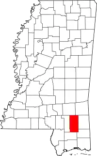
 Location of New Augusta, Mississippi | |
 New Augusta, Mississippi Location in the United States | |
| Coordinates: 31°12′15″N 89°1′55″W / 31.20417°N 89.03194°W | |
| Country | United States |
| State | Mississippi |
| County | Perry |
| Area | |
| • Total | 5.34 sq mi (13.82 km2) |
| • Land | 5.14 sq mi (13.32 km2) |
| • Water | 0.19 sq mi (0.50 km2) |
| Elevation | 112 ft (34 m) |
| Population (2020) | |
| • Total | 554 |
| • Density | 107.70/sq mi (41.58/km2) |
| Time zone | UTC-6 (Central (CST)) |
| • Summer (DST) | UTC-5 (CDT) |
| ZIP code | 39462 |
| Area code | 601 |
| FIPS code | 28-51040 |
| GNIS feature ID | 0694154 |
New Augusta is a town in Perry County, Mississippi. It is part of the Hattiesburg, Mississippi Metropolitan Statistical Area. The population was 644 at the 2010 census. It is the county seat of Perry County.[2] New Augusta is located about two miles south of "Old" Augusta, which was the county seat until 1906.
Geography
New Augusta is located at 31°12′15″N 89°1′55″W / 31.20417°N 89.03194°W (31.204062, -89.031957).[3]
According to the United States Census Bureau, the town has a total area of 5.3 square miles (14 km2), of which 5.2 square miles (13 km2) is land and 0.1 square miles (0.26 km2) (2.64%) is water.
Demographics
| Census | Pop. | Note | %± |
|---|---|---|---|
| 1870 | 80 | — | |
| 1960 | 275 | — | |
| 1970 | 511 | 85.8% | |
| 1980 | 589 | 15.3% | |
| 1990 | 668 | 13.4% | |
| 2000 | 715 | 7.0% | |
| 2010 | 644 | −9.9% | |
| 2020 | 554 | −14.0% | |
| U.S. Decennial Census[4] | |||
| Race | Num. | Perc. |
|---|---|---|
| White (non-Hispanic) | 302 | 54.51% |
| Black or African American (non-Hispanic) | 222 | 40.07% |
| Native American | 2 | 0.36% |
| Pacific Islander | 1 | 0.18% |
| Other/Mixed | 17 | 3.07% |
| Hispanic or Latino | 10 | 1.81% |
As of the 2020 United States census, there were 554 people, 238 households, and 165 families residing in the town.
Education
The Town of New Augusta is served by the Perry County School District.
See also
References
- ↑ "2020 U.S. Gazetteer Files". United States Census Bureau. Retrieved July 24, 2022.
- ↑ "Find a County". National Association of Counties. Retrieved June 7, 2011.
- ↑ "US Gazetteer files: 2010, 2000, and 1990". United States Census Bureau. February 12, 2011. Retrieved April 23, 2011.
- ↑ "Census of Population and Housing". Census.gov. Retrieved June 4, 2015.
- ↑ "Explore Census Data". data.census.gov. Retrieved December 16, 2021.
