Nieuw-Wehl | |
|---|---|
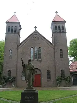
 Nieuw-Wehl church | |
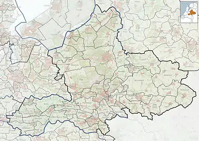
 Nieuw-Wehl Location in the province of Gelderland  Nieuw-Wehl Nieuw-Wehl (Netherlands) | |
| Coordinates: 51°58′2″N 6°10′18″E / 51.96722°N 6.17167°E | |
| Country | Netherlands |
| Province | Gelderland |
| Municipality | Doetinchem |
| Area | |
| • Total | 6.66 km2 (2.57 sq mi) |
| Elevation | 14 m (46 ft) |
| Population (2021)[1] | |
| • Total | 1,300 |
| • Density | 200/km2 (510/sq mi) |
| Time zone | UTC+1 (CET) |
| • Summer (DST) | UTC+2 (CEST) |
| Postal code | 7031[1] |
| Dialing code | 0314 |
Nieuw-Wehl is a village in the eastern Netherlands, about 10 km west of Doetinchem. Before 1 January 2005, it was part of the municipality of Wehl, along with neighboring village Wehl. After the division, Nieuw-Wehl joined the municipality of Doetinchem.[3]
Nieuw-Wehl was first mentioned between 1830 and 1855 as "Achter Wehl", meaning behind Wehl.[4] It started to develop in the early 20th century. In 1925, a Roman Catholic church was built.[5] In 1933, the name officially changed to Nieuw-Wehl.[4] The grist mill Bernadette was built in 1861 and restored in 1965 and 1998.[6]
Gallery
![The Bernadette [nl]](../I/NieuwWehl_Bernadette_01.JPG.webp) The Bernadette
The Bernadette Chapel in Nieuw-Wehl
References
- 1 2 3 "Kerncijfers wijken en buurten 2021". Central Bureau of Statistics. Retrieved 21 March 2022.
three entries
- ↑ "Postcodetool for 70314AA". Actueel Hoogtebestand Nederland (in Dutch). Het Waterschapshuis. Retrieved 21 March 2022.
- ↑ Ad van der Meer and Onno Boonstra, Repertorium van Nederlandse gemeenten, KNAW, 2011.
- 1 2 "Nieuw-Wehl". Etymologiebank (in Dutch). Retrieved 21 March 2022.
- ↑ Ronald Stenvert & Sabine Broekhoven (2000). "Wehl" (in Dutch). Zwolle: Waanders. p. 330. ISBN 90 400 9406 3. Retrieved 21 March 2022.
- ↑ "Bernadette". Plaatsengids (in Dutch). Retrieved 21 March 2022.
Wikimedia Commons has media related to Nieuw-Wehl.
This article is issued from Wikipedia. The text is licensed under Creative Commons - Attribution - Sharealike. Additional terms may apply for the media files.