Nijeholtwolde | |
|---|---|
Village | |
 | |
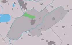 Location in Weststellingwerf municipality | |
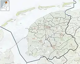 Nijeholtwolde Location in the Netherlands  Nijeholtwolde Nijeholtwolde (Netherlands) | |
| Coordinates: 52°53′42″N 5°59′8″E / 52.89500°N 5.98556°E | |
| Country | |
| Province | |
| Municipality | |
| Area | |
| • Total | 8.47 km2 (3.27 sq mi) |
| Elevation | 0.5 m (1.6 ft) |
| Population (2021)[1] | |
| • Total | 190 |
| • Density | 22/km2 (58/sq mi) |
| Postal code | 8488[1] |
| Dialing code | 0561 |
Nijeholtwolde (West Frisian: Nijeholtwâlde) is a village in Weststellingwerf in the province of Friesland, the Netherlands. It had a population of around 183 in 2017.[3]
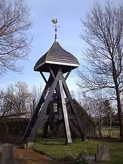
The village was first mentioned in 1320 as Nieholtwolt, and means "new low-lying wood". Nije (new) has been added to distinguish from Oldeholtwolde.[4][5] The church of Nijeholtwolde was demolished around 1700. There were no funds to rebuilt it, and a bell tower was constructed instead. The tower has been restored in 1982.[6]
In 1840, Nijeholtwolde was home to 225 people.[6]
References
- 1 2 3 "Kerncijfers wijken en buurten 2021". Central Bureau of Statistics. Retrieved 2 April 2022.
- ↑ "Postcodetool for 8488AK". Actueel Hoogtebestand Nederland (in Dutch). Het Waterschapshuis. Retrieved 2 April 2022.
- ↑ Villages - Weststellingwerf municipality (in Dutch)
- ↑ "Nijeholtwolde - (geografische naam)". Etymologiebank (in Dutch). Retrieved 2 April 2022.
- ↑ "Oldeholtwolde - (geografische naam)". Etymologiebank (in Dutch). Retrieved 2 April 2022.
- 1 2 "Nijeholtwolde". Plaatsengids (in Dutch). Retrieved 2 April 2022.
External links
![]() Media related to Nijeholtwolde at Wikimedia Commons
Media related to Nijeholtwolde at Wikimedia Commons
This article is issued from Wikipedia. The text is licensed under Creative Commons - Attribution - Sharealike. Additional terms may apply for the media files.