Nonnweiler | |
|---|---|
 | |
 Coat of arms | |
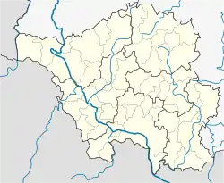
Location of Nonnweiler within Sankt Wendel district  | |
 Nonnweiler  Nonnweiler | |
| Coordinates: 49°37′N 6°57′E / 49.617°N 6.950°E | |
| Country | Germany |
| State | Saarland |
| District | Sankt Wendel |
| Subdivisions | 8 |
| Government | |
| • Mayor (2019–29) | Franz-Josef Barth[1] (SPD) |
| Area | |
| • Total | 66.71 km2 (25.76 sq mi) |
| Elevation | 414 m (1,358 ft) |
| Population (2021-12-31)[2] | |
| • Total | 8,458 |
| • Density | 130/km2 (330/sq mi) |
| Time zone | UTC+01:00 (CET) |
| • Summer (DST) | UTC+02:00 (CEST) |
| Postal codes | 66616–66620 |
| Dialling codes | 06873 |
| Vehicle registration | WND |
| Website | www.nonnweiler.de |
Nonnweiler is a municipality in the district of Sankt Wendel, in Saarland, Germany.
Overview
It is situated approximately 20 km northwest of Sankt Wendel, and 30 km southeast of Trier. The village is well known for the "Hillfort of Otzenhausen", a huge wall (former castle) of Celtic origin.
References
- ↑ Gewählte Ober-/Bürgermeister*innen, Landrät*innen und Regionalverbandsdirektor*in im Saarland, Statistisches Amt des Saarlandes, 27 March 2022.
- ↑ "Amtliche Einwohnerzahlen Stand 31. Dezember 2021" (PDF) (in German). Statistisches Amt des Saarlandes. June 2022.
External links
 Media related to Nonnweiler at Wikimedia Commons
This article is issued from Wikipedia. The text is licensed under Creative Commons - Attribution - Sharealike. Additional terms may apply for the media files.