Nur County
Persian: شهرستان نور | |
|---|---|
County | |
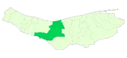 Location of Nur County in Mazandaran province | |
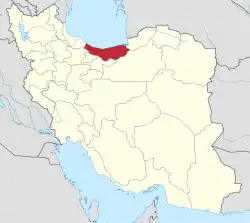 Location of Mazandaran province in Iran | |
| Coordinates: 36°19′N 51°49′E / 36.317°N 51.817°E[1] | |
| Country | |
| Province | Mazandaran |
| Capital | Nur |
| Districts | Central, Baladeh, Chamestan |
| Area | |
| • Total | 2,675.00 km2 (1,032.82 sq mi) |
| Population (2016)[3] | |
| • Total | 121,531 |
| • Density | 45/km2 (120/sq mi) |
| Time zone | UTC+3:30 (IRST) |
| Nur County can be found at GEOnet Names Server, at this link, by opening the Advanced Search box, entering "9207270" in the "Unique Feature Id" form, and clicking on "Search Database". | |
Nur County (Persian: شهرستان نور) is in Mazandaran province, Iran. Its capital is the city of Nur.[4]
At the 2006 census, the county's population was 104,807 in 27,699 households.[5] The following census in 2011 counted 109,281 people in 32,461 households.[6] At the 2016 census, the county's population was 121,531 in 39,350 households.[3]
Administrative divisions
The population history of Nur County's administrative divisions over three consecutive censuses is shown in the following table. The latest census shows three districts, nine rural districts, and five cities.[3]
| Administrative Divisions | 2006[5] | 2011[6] | 2016[3] |
|---|---|---|---|
| Central District | 57,530 | 61,497 | 69,601 |
| Mian Band RD | 8,719 | 9,935 | 11,065 |
| Natel Kenar-e Olya RD | 10,809 | 11,524 | 13,328 |
| Natel Kenar-e Sofla RD | 2,975 | 3,161 | 3,091 |
| Izadshahr (city) | 6,882 | 6,797 | 7,439 |
| Nur (city) | 21,806 | 22,978 | 26,947 |
| Royan (city) | 6,339 | 7,102 | 7,731 |
| Baladeh District | 6,594 | 5,739 | 7,630 |
| Owzrud RD | 1,811 | 1,400 | 2,452 |
| Sheykh Fazlolah-e Nuri RD | 2,114 | 2,327 | 3,231 |
| Tatarestaq RD | 1,535 | 975 | 977 |
| Baladeh (city) | 1,134 | 1,037 | 970 |
| Chamestan District | 40,683 | 42,045 | 44,300 |
| Lavij RD | 3,229 | 2,968 | 3,239 |
| Mianrud RD | 13,906 | 13,953 | 14,259 |
| Natel-e Restaq RD | 14,067 | 14,507 | 15,608 |
| Chamestan (city) | 9,481 | 10,617 | 11,194 |
| Total | 104,807 | 109,281 | 121,531 |
| RD: Rural District | |||
Wikimedia Commons has media related to Nur County.
References
- ↑ OpenStreetMap contributors (27 May 2023). "Nur County" (Map). OpenStreetMap. Retrieved 27 May 2023.
- ↑ Management and Planning Organization of Mazandaran, 2006
- 1 2 3 4 "Census of the Islamic Republic of Iran, 1395 (2016)". AMAR (in Persian). The Statistical Center of Iran. p. 02. Archived from the original (Excel) on 7 October 2021. Retrieved 19 December 2022.
- ↑ Habibi, Hassan (21 June 1369). "Approval of the organization and chain of citizenship of the elements and units of the divisions of Mazandaran province, centered in Sari city". Lamtakam (in Persian). Ministry of Interior, Defense Political Commission of the Government Council. Archived from the original on 14 January 2024. Retrieved 14 January 2024.
- 1 2 "Census of the Islamic Republic of Iran, 1385 (2006)". AMAR (in Persian). The Statistical Center of Iran. p. 02. Archived from the original (Excel) on 20 September 2011. Retrieved 25 September 2022.
- 1 2 "Census of the Islamic Republic of Iran, 1390 (2011)". Syracuse University (in Persian). The Statistical Center of Iran. p. 02. Archived from the original (Excel) on 19 January 2023. Retrieved 19 December 2022.
This article is issued from Wikipedia. The text is licensed under Creative Commons - Attribution - Sharealike. Additional terms may apply for the media files.