| North Dam | |
|---|---|
 | |
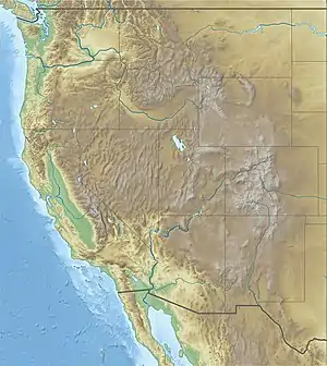
 Location of North Dam in the western U.S. | |
| Country | United States |
| Location | Grant County, Washington |
| Coordinates | 47°56′27.03″N 119°1′2.66″W / 47.9408417°N 119.0174056°W |
| Construction began | 1946[1] |
| Opening date | 1951[1] |
| Operator(s) | United States Bureau of Reclamation |
| Dam and spillways | |
| Type of dam | Embankment, earth-fill |
| Impounds | Grand Coulee |
| Height | 145 ft (44 m)[2] |
| Length | 1,450 ft (442 m)[2] |
| Elevation at crest | 1,580 ft (480 m) |
| Reservoir | |
| Creates | Banks Lake |
| Total capacity | 1,275,000 acre⋅ft (1.573 km3)[3] |
| Active capacity | 715,000 acre⋅ft (0.882 km3) |
| Catchment area | 278.3 sq mi (721 km2)[3] |
| Surface area | 27,000 acres (109 km2) |
| Normal elevation | 1,570 ft (480 m) |
North Dam is an earth-fill embankment dam near the town of Grand Coulee in Grant County, Washington, United States. Construction of the dam began in 1946 and it was completed in 1951.[1] Along with Dry Falls Dam about 22 mi (35 km) to the southeast, North Dam creates the reservoir Banks Lake within the ancient Grand Coulee riverbed. The lake serves as the equalizer reservoir of the Columbia Basin Project. Near the North Dam's left abutment is the entrance to the feeder canal of the project. The canal serves to either deliver water to the pump-generating plant at Grand Coulee Dam or return water to Banks Lake from the same pumped-storage plant.[4]
The North Dam, near the town of Grand Coulee, has a maximum height of 145 feet (44 m) and a crest length of 1,400 feet (430 m).[5] Crest elevation of both dams is 1,580 feet (480 m), and the maximum water level in Banks Lake is elevation 1,570 feet (480 m). Both North and Dry Falls dams have 10 feet (3.0 m) of freeboard for protection against wave action due to high winds.
External links
References
- 1 2 3 United States Bureau of Reclamation (2012-06-21). "North Dam: General". Archived from the original on 2015-06-16. Retrieved 2015-01-23.
- 1 2 The Story of the Columbia Basin Project. Washington D.C.: United States Government Printing Office. 1964. p. 59.
- 1 2 United States Bureau of Reclamation (2012-05-17). "Dry Falls Dam: Hydraulics and Hydrology". Archived from the original on 2015-06-16. Retrieved 2015-01-23.
- ↑ "North Dam - Overview". U.S. Bureau of Reclamation. Archived from the original on 5 September 2015. Retrieved 24 January 2015.
- ↑ Draft Environmental Statement, Columbia Basin Project, Washington; Columbia Basin Project, Ephrata, Washington; Department of the Interior, (INT DES-75-3), Bureau of Reclamation, Department of the Interior; Washington, D.C.; 1975