North Hatley | |
|---|---|
 | |
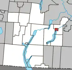
 Location within Memphrémagog RCM | |
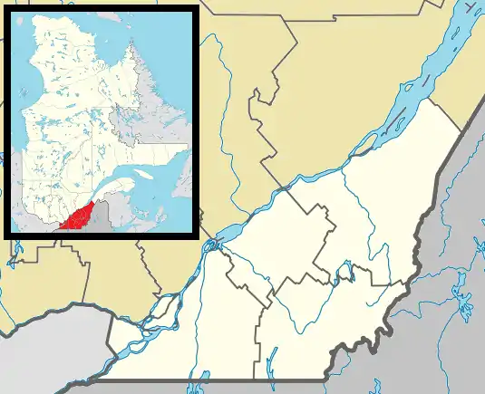
 North Hatley Location in southern Quebec | |
| Coordinates: 45°17′N 71°58′W / 45.283°N 71.967°W[1] | |
| Country | Canada |
| Province | Quebec |
| Region | Estrie |
| RCM | Memphrémagog |
| Constituted | October 25, 1897 |
| Named for | Hatley, Cambridgeshire[1] |
| Government | |
| • Mayor | Marcella Davis Gerrish (2021–Present) |
| • Federal riding | Compton—Stanstead |
| • Prov. riding | Orford |
| Area | |
| • Total | 4.60 km2 (1.78 sq mi) |
| • Land | 3.35 km2 (1.29 sq mi) |
| Elevation | 167 m (548 ft) |
| Population (2016)[4] | |
| • Total | 632 |
| • Density | 188.4/km2 (488/sq mi) |
| • Pop 2011-2016 | |
| • Dwellings | 448 |
| Time zone | UTC−5 (EST) |
| • Summer (DST) | UTC−4 (EDT) |
| Postal code(s) | |
| Area code | 819 |
| Highways | |
| Website | www |
North Hatley is a village of 675 people (2021 Census), located at the north end of Lake Massawippi. It is part of the Memphrémagog Regional County Municipality in the Eastern Townships region of Quebec, Canada, also known as Estrie or Cantons de l'Est in French.

Locals usually have to drive to the nearby towns of Magog or Sherbrooke to find big-city amenities, although there are smaller stores and cafés in the town which are open year-round. Those include Emporium (antiques), The Pomegranate (antiques), LeBaron's Store (grocery store and gift shop), The Pilsen Pub, and Accommodation Massawippi (convenience store) among others.
History
Many of the first settlers around North Hatley were United Empire Loyalists, mostly farmers, who left New England in the years following the American Declaration of Independence in 1776.
The village owes most of its great houses and particular architecture to its first aristocrats, and mostly Americans from south of the Mason–Dixon line.
Demographics
| Year | Pop. | ±% |
|---|---|---|
| 1986 | 715 | — |
| 1991 | 704 | −1.5% |
| 1996 | 758 | +7.7% |
| 2001 | 746 | −1.6% |
| 2006 | 722 | −3.2% |
| 2011 | 654 | −9.4% |
| 2016 | 632 | −3.4% |
| Source: Statistics Canada[4] | ||
In the 2021 Census of Population conducted by Statistics Canada, North Hatley had a population of 675 living in 319 of its 450 total private dwellings, a change of 6.8% from its 2016 population of 632. With a land area of 3.35 km2 (1.29 sq mi), it had a population density of 201.5/km2 (521.9/sq mi) in 2021.[5]
| 2021 | 2016 | 2011 | |
|---|---|---|---|
| Population | 675 (+6.8% from 2016) | 632 (-3.4% from 2011) | 654 (-9.4% from 2006) |
| Land area | 3.35 km2 (1.29 sq mi) | 3.35 km2 (1.29 sq mi) | 3.34 km2 (1.29 sq mi) |
| Population density | 201.5/km2 (522/sq mi) | 188.4/km2 (488/sq mi) | 195.9/km2 (507/sq mi) |
| Median age | 57.6 (M: 56.8, F: 58.4) | 56.1 (M: 54.0, F: 56.9) | 56.0 (M: 55.2, F: 57.6) |
| Private dwellings | 315 (total) | 448 (total) | 458 (total) |
| Median household income | $57,024 | $51,891 |
Local government
List of former mayors:
- Stephan Doré (2001–2009)
- Michael Page (2009–2021)
- Marcella Davis Gerrish (2021–Present)
In media
North Hatley was the location for the shooting of a few films, including Secret Window with Johnny Depp.[11][12]
North Hatley was mentioned in the television show The X-Files as the location of the Cigarette Smoking Man's hideout (in the episode "The Red and the Black").
North Hatley was the setting for the 2003 film Hatley High. Some of its landmarks, including the North Hatley sign, can be seen throughout the movie. However, the bulk of the movie was filmed in Hudson.
Notable people
Several Canadian Modernist poets, including F. R. Scott, Louis Dudek, Ralph Gustafson, Ronald Sutherland, and D. G. Jones, have lived in North Hatley.[13]
It is also home to many artists and craftspeople, including Emily LeBaron, an artist, antiquarian, art teacher and community organizer, and also Naisi LeBaron, known locally for her "art naive" paintings of village life in North Hatley and environs, as well as local graphic artist Mellanie Beauchamp.
North Hatley also has in its history philanthropists well committed to their community, such as Arthur Russell Virgin and Janet Blake.
See also
References
- 1 2 "Banque de noms de lieux du Québec: Reference number 142203". toponymie.gouv.qc.ca (in French). Commission de toponymie du Québec.
- 1 2 "Répertoire des municipalités: Geographic code 45050". www.mamh.gouv.qc.ca (in French). Ministère des Affaires municipales et de l'Habitation.
- ↑ "ParlInfo Has Moved". lop.parl.ca. Retrieved August 14, 2019.
- 1 2 3 "North Hatley (Code 2445050) Census Profile". 2016 census. Government of Canada - Statistics Canada.
- ↑ "Population and dwelling counts: Canada, provinces and territories, and census subdivisions (municipalities), Quebec". Statistics Canada. February 9, 2022. Retrieved August 28, 2022.
- ↑ "2021 Community Profiles". 2021 Canadian Census. Statistics Canada. February 4, 2022. Retrieved 2022-04-27.
- ↑ "2016 Community Profiles". 2016 Canadian Census. Statistics Canada. August 12, 2021. Retrieved 2020-08-12.
- ↑ "2011 Community Profiles". 2011 Canadian Census. Statistics Canada. March 21, 2019. Retrieved 2020-08-12.
- ↑ "2006 Community Profiles". 2006 Canadian Census. Statistics Canada. August 20, 2019.
- ↑ "2001 Community Profiles". 2001 Canadian Census. Statistics Canada. July 18, 2021.
- ↑ "The Stanstead Journal - Google News Archive Search". news.google.com. Retrieved August 14, 2019.
- ↑ "North Hatley Travel Guide: North Hatley, Quebec (QC) | WORLDWEB.COM". www.southstlawrence.worldweb.com. Retrieved August 14, 2019.
- ↑ Susan Stromberg-Stein, Louis Dudek: A Biographical Introduction to his Poetry, 131.