Novomykolaivka
Новомиколаївка | |
|---|---|
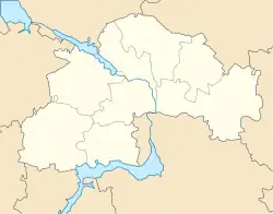
 Novomykolaivka Location of Novomykolaivka within Ukraine  Novomykolaivka Novomykolaivka (Ukraine) | |
| Coordinates: 47°50′36″N 36°29′48″E / 47.84333°N 36.49667°E | |
| Country | |
| Oblast | |
| Raion | Synelnykove Raion |
| Established | 1921 |
| Area | |
| • Total | 0.058 km2 (0.022 sq mi) |
| Elevation | 99 m (325 ft) |
| Population | |
| • Total | 155 |
| • Density | 2,672.41/km2 (6,921.5/sq mi) |
| Code | 53624 |
Novomykolaivka (Ukrainian: Новомиколаївка) is a rural village in the Synelnykove Raion of the Dnipropetrovsk Oblast, Ukraine. It has a population of 155. The body of local self-government is Berezivka village council.
Locale
The village used to be in the Pokrovske Raion, until it was liquidified into the Synelnykove Raion.[1] Located close to Zaporizke and Ternove. A drying stream with a dam flows through the village. The elevation is 99 meters.[2]
History
During the Russian invasion of Ukraine, DPR and Russian forces engaged in battles near Novomykolaivka and its environs.[3]
References
- ↑ "Про утворення та ліквідацію районів". Офіційний вебпортал парламенту України (in Ukrainian). Retrieved 2023-04-08.
- ↑ "weather.in.ua - погода в с. Новомиколаївка (Дніпропетровська область, Покровський район) - прогноз погоди в Україні на 3 та 5 днів". weather.in.ua. Retrieved 2023-04-08.
- ↑ "Institute for the Study of War". Institute for the Study of War. Archived from the original on 2022-03-25. Retrieved 2023-04-08.
This article is issued from Wikipedia. The text is licensed under Creative Commons - Attribution - Sharealike. Additional terms may apply for the media files.