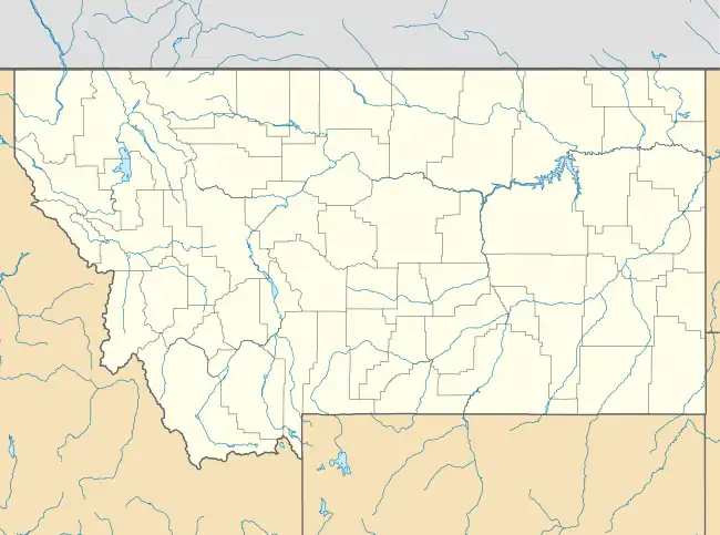
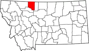
Oilmont, Montana | |
|---|---|
 Oilmont, Montana  Oilmont, Montana | |
| Coordinates: 48°44′24″N 111°50′27″W / 48.74000°N 111.84083°W | |
| Country | United States |
| State | Montana |
| County | Toole |
| Elevation | 3,501 ft (1,067 m) |
| Time zone | UTC-7 (Mountain (MST)) |
| • Summer (DST) | UTC-6 (MDT) |
| ZIP code | 59466[1] |
| Area code | 406 |
| GNIS feature ID | 774918[2] |
Oilmont is an abandoned community located in the state of Montana. The community was abandoned when chemicals used in oil extraction contaminated the local water table.
Oilmont was an unincorporated community in Toole County, Montana, United States.[2] Interstate 15 passes near the community, with access from Exit 379.
It is the location of Bethany Lutheran Church, which is listed on the National Register of Historic Places.[3] The Absure Refinery processed petroleum from the nearby Kevin Sunburst Oil Field.[4]
Climate
Dunkirk 19NNE is a nearby weather station, located 16 miles (25.7 km) west of Oilmont.[5] Dunkirk 19NNE has a cold semi-arid climate (Köppen BSk).
| Climate data for Dunkirk 19NNE, Montana, 1991–2020 normals, 1922-2020 extremes: 3323ft (1013m) | |||||||||||||
|---|---|---|---|---|---|---|---|---|---|---|---|---|---|
| Month | Jan | Feb | Mar | Apr | May | Jun | Jul | Aug | Sep | Oct | Nov | Dec | Year |
| Record high °F (°C) | 63 (17) |
69 (21) |
79 (26) |
89 (32) |
94 (34) |
102 (39) |
105 (41) |
108 (42) |
98 (37) |
90 (32) |
74 (23) |
68 (20) |
108 (42) |
| Mean maximum °F (°C) | 52.9 (11.6) |
52.6 (11.4) |
63.1 (17.3) |
75.8 (24.3) |
83.6 (28.7) |
89.1 (31.7) |
96.2 (35.7) |
95.2 (35.1) |
89.6 (32.0) |
78.2 (25.7) |
63.6 (17.6) |
52.2 (11.2) |
97.6 (36.4) |
| Mean daily maximum °F (°C) | 29.4 (−1.4) |
33.6 (0.9) |
43.0 (6.1) |
55.0 (12.8) |
65.1 (18.4) |
72.3 (22.4) |
81.9 (27.7) |
81.3 (27.4) |
70.4 (21.3) |
56.5 (13.6) |
41.4 (5.2) |
32.1 (0.1) |
55.2 (12.9) |
| Daily mean °F (°C) | 16.9 (−8.4) |
20.2 (−6.6) |
29.8 (−1.2) |
41.1 (5.1) |
51.2 (10.7) |
58.7 (14.8) |
65.9 (18.8) |
64.9 (18.3) |
54.6 (12.6) |
41.3 (5.2) |
28.2 (−2.1) |
18.9 (−7.3) |
41.0 (5.0) |
| Mean daily minimum °F (°C) | 4.5 (−15.3) |
6.8 (−14.0) |
16.6 (−8.6) |
27.1 (−2.7) |
37.4 (3.0) |
45.1 (7.3) |
49.9 (9.9) |
48.5 (9.2) |
38.8 (3.8) |
26.1 (−3.3) |
14.9 (−9.5) |
5.8 (−14.6) |
26.8 (−2.9) |
| Mean minimum °F (°C) | −24.3 (−31.3) |
−17.9 (−27.7) |
−7.3 (−21.8) |
10.3 (−12.1) |
21.5 (−5.8) |
33.9 (1.1) |
37.8 (3.2) |
35.8 (2.1) |
26.4 (−3.1) |
6.7 (−14.1) |
−8.4 (−22.4) |
−19.2 (−28.4) |
−31.3 (−35.2) |
| Record low °F (°C) | −46 (−43) |
−42 (−41) |
−34 (−37) |
−17 (−27) |
7 (−14) |
22 (−6) |
31 (−1) |
29 (−2) |
2 (−17) |
−15 (−26) |
−33 (−36) |
−40 (−40) |
−46 (−43) |
| Average precipitation inches (mm) | 0.33 (8.4) |
0.28 (7.1) |
0.42 (11) |
0.99 (25) |
1.67 (42) |
2.61 (66) |
1.10 (28) |
0.88 (22) |
1.05 (27) |
0.58 (15) |
0.44 (11) |
0.29 (7.4) |
10.64 (269.9) |
| Average snowfall inches (cm) | 5.0 (13) |
5.2 (13) |
4.9 (12) |
3.7 (9.4) |
0.5 (1.3) |
0.1 (0.25) |
0.0 (0.0) |
0.0 (0.0) |
0.3 (0.76) |
2.2 (5.6) |
4.5 (11) |
5.5 (14) |
31.9 (80.31) |
| Source 1: NOAA[6] | |||||||||||||
| Source 2: XMACIS (2002-2020 snowfall, temp records & monthly max/mins)[7] | |||||||||||||
References
- ↑ United States Postal Service (2012). "USPS - Look Up a ZIP Code". Retrieved February 15, 2012.
- 1 2 "Oilmont". Geographic Names Information System. United States Geological Survey, United States Department of the Interior.
- ↑ "National Register Information System". National Register of Historic Places. National Park Service. July 9, 2010.
- ↑ "Oilmont". Montana Place Names Companion. Montana Historical Society. Retrieved April 7, 2021.
- ↑ "Data of Meteorological Station Dunkirk 19Nne, Montana". geographic.org. Retrieved December 28, 2023.
- ↑ "Dunkirk 19NNE, Montana 1991-2020 Monthly Normals". Retrieved December 28, 2023.
- ↑ "xmACIS". National Oceanic and Atmospheric Administration. Retrieved December 28, 2023.
This article is issued from Wikipedia. The text is licensed under Creative Commons - Attribution - Sharealike. Additional terms may apply for the media files.
