| Overflowing River | |
|---|---|
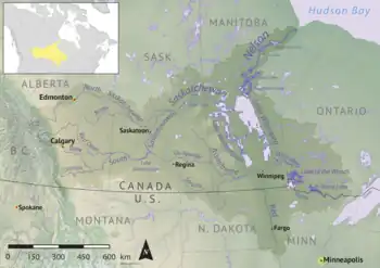 Map of the Nelson River drainage basin | |
 Location of river's mouth in Manitoba 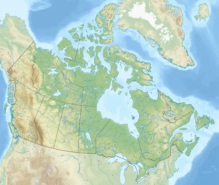 Overflowing River (Canada) | |
| Location | |
| Country | Canada |
| Provinces | |
| Physical characteristics | |
| Source | Overflow Lake |
| • location | RM of Hudson Bay No. 394, Saskatchewan |
| • coordinates | 53°08′52″N 102°29′00″W / 53.1479°N 102.4832°W |
| • elevation | 637 m (2,090 ft) |
| Mouth | Overflowing Bay, Lake Winnipegosis |
• location | Overflowing River Sapotaweyak Cree Nation Indian Reserve, Northern Manitoba |
• coordinates | 53°07′48″N 101°05′01″W / 53.1301°N 101.0836°W |
• elevation | 254 m (833 ft) |
| Basin features | |
| River system | Nelson River |
| Tributaries | |
| • left |
|
| • right |
|
| Waterbodies | Leaf Lake |
Overflowing River[1] is a river in the Canadian provinces of Manitoba and Saskatchewan. It begins in Saskatchewan at Overflow Lake[2] in the Pasquia Provincial Forest and flows in a generally eastward direction into Manitoba and then Lake Winnipegosis. The river traverses boreal forests and muskeg in the Boreal Plains Ecozone, moving from the Mid-Boreal Upland of the Pasquia Hills east to the Mid-Boreal Lowland.[3]
Course
Overflowing River begins at the south end of Overflow Lake in the Pasquia Hills, just south of the southern boundary of Wildcat Hill Provincial Park. The river flows south out of the hills towards the town Hudson Bay, where it crosses Highway 2 and then turns east. A small provincial ecological reserve called Overflowing River Recreation Site is at the intersection of the river and Highway 2.[4][5] From Highway 2 eastward, Overflowing River parallels the Red Deer River as it flows towards Manitoba. Once in Manitoba, Overflowing River continues eastward and then empties into Overflowing Bay at Lake Winnipegosis.[6][7] At the river's mouth is the small community of Overflowing River, Overflowing River Provincial Park,[8] and Overflowing River Sapotaweyak Cree Nation Indian Reserve.
Tributaries
The tributaries of Overflowing River[9] from its headwaters to its mouth:
- Teepee Creek
- Leaf River
- Ceba Creek
- Berdahl Creek
- Chemong Creek
- North Chemong Creek
- Rat Creek
- Senton River
Fish species
Fish commonly found in Overflowing River include walleye, northern pike, yellow perch, freshwater drum, common carp, and brown bullhead.[10] Overflowing River Provincial Park, which is accessed from Manitoba's Highway 10, provides access to the river for fishing.[11]
See also
References
- ↑ "Overflowing River". Canadian Geographical Names Database. Government of Canada. Retrieved 4 November 2023.
- ↑ "Overflow Lake". SaskLakes. Retrieved 4 November 2023.
- ↑ "Ecoregions of Saskatchewan". usask. University of Saskatchewan. 30 May 2008. Retrieved 4 November 2023.
- ↑ "Overflowing River Recreation Site". Canadian Geographical Names Database. Government of Canada. Retrieved 4 November 2023.
- ↑ "Ecological Reserves in the Hudson Bay Area". Town of Hudson Bay. Retrieved 6 November 2023.
- ↑ "Overflowing River, Saskatchewan, Canada". Mindat.org. mindat.org and the Hudson Institute of Mineralogy. Retrieved 4 November 2023.
- ↑ "Map of Overflowing River in Saskatchewan:". Cartographic.info. Retrieved 4 November 2023.
- ↑ "Overflowing River Provincial Park". Geoview.info. Retrieved 4 November 2023.
- ↑ "Overflowing River". Geoview.info. Retrieved 4 November 2023.
- ↑ "Overflowing River". FishBrain. Retrieved 4 November 2023.
- ↑ "Overflowing River". Swan Valley Sport Fishing. Swan Valley Sport Fishing Enhancement Inc. Retrieved 4 November 2023.