| Parbig Парбиг | |
|---|---|
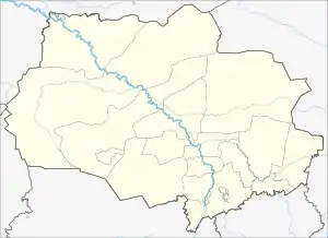
 Mouth location in Tomsk Oblast, Russia | |
| Location | |
| Country | Russia |
| Physical characteristics | |
| Source | Vasyugan Swamp |
| Mouth | |
• coordinates | 57°36′45″N 82°17′35″E / 57.61250°N 82.29306°E |
| Length | 320 km (200 mi) |
| Basin size | 9,180 km2 (3,540 sq mi) |
| Basin features | |
| Progression | Chaya → Ob→ Kara Sea |
Parbig (Russian: Парбиг) is a river in Tomsk Oblast, Russia. It gives origin to the Chaya river.[1]
Course
It has its sources in the Vasyugan Swamp. It flows roughly in a northeastern direction across Bakcharsky district into Chainsky district, where it meets the Bakchar; the two flow into one another and become the Chaya, a tributary of the Ob.
Tributaries
Its main tributary is the 232 km (144 mi) long Andarma on the right.[1] Listed by distance from the river's mouth, other tributaries are:[1]
- 18 km (11 mi): Upper Nyursa
- 34 km (21 mi): Bundyur
- 64 km (40 mi): Vshivka
- 68 km (42 mi): Andarma
- 97 km (60 mi): Kedrovka (lower tributary)
- 105 km (65 mi): Nilga
- 116 km (72 mi): Nizhnyaya Mokhovaya
- 138 km (86 mi): Penzyachka
- 143 km (89 mi): Spirtovka
- 152 km (94 mi): Verkhnyaya Mokhovaya
- 180 km (110 mi): Kedrovka (upper tributary)
- 184 km (114 mi): Dvoychaga
- 210 km (130 mi): (unnamed river)
- 212 km (132 mi): Silenskaya
- 218 km (135 mi): Chaga
- 231 km (144 mi): Burka
- 251 km (156 mi): (unnamed river)
- 252 km (157 mi): Gar
- 278 km (173 mi): Smorodinka
- 279 km (173 mi): Kudreyka
References
- 1 2 3 "Государственный водный реестр: река Парбиг". textual.ru. Retrieved 2021-11-14.
This article is issued from Wikipedia. The text is licensed under Creative Commons - Attribution - Sharealike. Additional terms may apply for the media files.