Pioneer, Florida | |
|---|---|
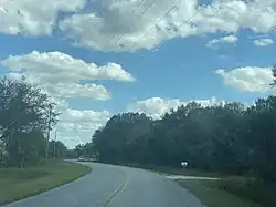 Hendry Isles Blvd in Pioneer | |
 Pioneer  Pioneer | |
| Coordinates: 26°43′33″N 81°13′08″W / 26.72583°N 81.21889°W | |
| Country | United States |
| State | Florida |
| County | Hendry |
| Area | |
| • Total | 21.17 sq mi (54.82 km2) |
| • Land | 21.16 sq mi (54.80 km2) |
| • Water | 0.01 sq mi (0.03 km2) |
| Elevation | 20 ft (6 m) |
| Population (2020) | |
| • Total | 752 |
| • Density | 35.54/sq mi (13.72/km2) |
| Time zone | UTC-5 (Eastern (EST)) |
| • Summer (DST) | UTC-4 (EDT) |
| Area code | 863 |
| GNIS feature ID | 2583375[2] |
Pioneer, also known as Pionner Plantation,[3] is an unincorporated community and census-designated place in Hendry County, Florida, United States. Its population was 752 as of the 2020 census.
Geography
According to the U.S. Census Bureau, the community has an area of 21.233 square miles (54.99 km2); 21.223 square miles (54.97 km2) of its area is land, and 0.010 square miles (0.026 km2) is water.[4]
Pioneer has the Pioneer Community Park at 910 Panama Avenue. It includes a 2,400 square feet community center, sports fields and courts, playground equipment, 2 grills, and a picnic table.[5]
Demographics
| Census | Pop. | Note | %± |
|---|---|---|---|
| 2020 | 752 | — | |
| U.S. Decennial Census[6] | |||
References
- ↑ "2020 U.S. Gazetteer Files". United States Census Bureau. Retrieved October 31, 2021.
- ↑ "Pioneer Census Designated Place". Geographic Names Information System. United States Geological Survey, United States Department of the Interior.
- ↑ "Hendry County - Board of Commissioners" (PDF).
- ↑ "2010 Census Gazetteer Files - Places: Florida". U.S. Census Bureau. Retrieved March 26, 2017.
- ↑ "Welcome to Hendry County, FL". www.hendryfla.net. Retrieved June 3, 2023.
- ↑ "Census of Population and Housing". Census.gov. Retrieved June 4, 2016.
Municipalities and communities of Hendry County, Florida, United States | ||
|---|---|---|
| Cities |  | |
| CDPs | ||
| Indian reservation | ||
| Unincorporated community | ||
| Footnotes | ‡This populated place also has portions in an adjacent county or counties | |
This article is issued from Wikipedia. The text is licensed under Creative Commons - Attribution - Sharealike. Additional terms may apply for the media files.