Pioneer Township | |
|---|---|
 Location in Graham County | |
| Coordinates: 39°32′05″N 099°40′56″W / 39.53472°N 99.68222°W | |
| Country | United States |
| State | Kansas |
| County | Graham |
| Area | |
| • Total | 62.15 sq mi (160.96 km2) |
| • Land | 62.14 sq mi (160.93 km2) |
| • Water | 0.01 sq mi (0.02 km2) 0.01% |
| Elevation | 2,247 ft (685 m) |
| Population (2000) | |
| • Total | 57 |
| • Density | 0.9/sq mi (0.4/km2) |
| GNIS feature ID | 0472122 |
Pioneer Township is a township in Graham County, Kansas, USA. As of the 2000 census, its population was 57.
Geography
Pioneer Township covers an area of 62.15 square miles (161.0 km2) and contains no incorporated settlements. According to the USGS, it contains four cemeteries: Buchanan Brown, McFarland, Prairie Dale and Whitfield.
References
External links
Municipalities and communities of Graham County, Kansas, United States | ||
|---|---|---|
| Cities | 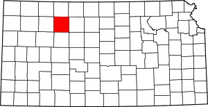 Map of Kansas highlighting Graham County | |
| Unincorporated communities | ||
| Ghost towns | ||
| Townships | ||
| Footnotes | †This community is designated a Census-Designated Place (CDP) by the United States Census Bureau. | |
This article is issued from Wikipedia. The text is licensed under Creative Commons - Attribution - Sharealike. Additional terms may apply for the media files.