Polonnaruwa District
පොළොන්නරුව දිස්ත්රික්කය பொலன்னறுவை மாவட்டம் | |
|---|---|
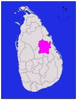 Map of Sri Lanka with Polonnaruwa District highlighted | |
| Coordinates: 8°00′N 81°00′E / 8.000°N 81.000°E | |
| Country | Sri Lanka |
| Province | North Central Province |
| Largest Town | Polonnaruwa |
| DS Division[1] | List
|
| Government | |
| • District Secretary | W. A. Dharmasiri |
| • MPs | |
| • MPCs[2] | List
|
| Area | |
| • Total | 3,293 km2 (1,271 sq mi) |
| • Land | 3,077 km2 (1,188 sq mi) |
| • Water | 216 km2 (83 sq mi) 6.55% |
| • Rank | 5th (5.01% of total area) |
| Population (2012)[4] | |
| • Total | 403,335 |
| • Density | 120/km2 (320/sq mi) |
| Ethnicity | |
| • Sinhalese | 365,476 (90.6%) |
| • Moors | 29,060 (7.2%) |
| • Sri Lankan Tamil | 7,356 (1.8%) |
| • Indian Tamil | 1,190 (0.3%) |
| • Other | 253 (0.06%) |
| Religion | |
| • Buddhist | 361,920 (89.7%) |
| • Muslim | 30,427 (7.5%) |
| • Hindu | 6,835 (1.7%) |
| • Christian | 4,090 (1.00%) |
| • Other | 63 (0.01%) |
| Time zone | UTC+05:30 (Sri Lanka) |
| Post Codes | 51000 |
| Telephone Codes | 027 |
| ISO 3166 code | LK-72 |
| Vehicle registration | NC |
| Official Languages | Sinhala, Tamil |
Polonnaruwa District (Sinhala: පොළොන්නරුව දිස්ත්රික්කය; Tamil: பொலன்னறுவை மாவட்டம்) is one of the 25 districts of Sri Lanka, the second level administrative division of the country. It is also one of the two districts of North Central Province and has an area of 3,293 km2.[7]
The district is administered by a District Secretariat headed by a District Secretary (previously known as a Government Agent) appointed by the central government of Sri Lanka. The capital of the district is the city of Polonnaruwa.
Administrative Units
| DS Division | Main Town | Divisional Secretary | GN Divisions |
Area (km2) |
Population |
|---|---|---|---|---|---|
| Thamankaduwa | Polonnaruwa | Mr.H.S.K.J Bandara | 55 | 468.78 | 94254 |
| Hingurakgoda | Hingurakgoda | Mr.H.S.K.J Bandara(Acting) | 53 | 709.04 | 77202 |
| Medirigiriya | Medirigiriya | Mr.W.M.I Karunarathne | 45 | 574.04 | 78654 |
| Lankapura | Thalpotha | Miss.R.W.R.M.C Ranawarna | 27 | 184 | 43365 |
| Welikanda | Welikanda | Mrs.M.M Hairunnisha | 29 | 548 | 42700 |
| Dimbulagala | Manampitiya | Mr.P.T.M Irfan | 56 | 581.83 | 95807 |
| Elahera | Bakamuna | Mr.C.M Karunarathne | 28 | 227.31 | 49924 |
Demographics
Ethnicity
The majority of the population are Sinhalese with a minority Sri Lankan Moor and Sri Lankan Tamil population.[8]
Religion
According to the 2011 census[10] 89.7% of the population were Buddhists, 7.5% Muslim, 1.7% Hindu and 1% Christian.
Politics and government
Local government
| Local Authority | Registered Electors |
Elected Members | |||||
|---|---|---|---|---|---|---|---|
| SLPP | SLFP | UNP | JVP | Other | Total | ||
| Dimbulagala Divisional Council | 64142 | 7 | 7 | 6 | 1 | 0 | 21 |
| Elahera Divisional Council | 36567 | 9 | 4 | 4 | 0 | 1 | 18 |
| Hingurakgoda Divisional Council | 50546 | 13 | 10 | 8 | 2 | 0 | 33 |
| Lankapura Divisional Council | 28369 | 6 | 8 | 7 | 1 | 2 | 24 |
| Medirigiriya Divisional Council | 52530 | 14 | 9 | 9 | 2 | 0 | 34 |
| Polonnaruwa Divisional Council | 38459 | 5 | 8 | 3 | 1 | 0 | 17 |
| Polonnaruwa Municipal Council | 24809 | 3 | 5 | 2 | 1 | 0 | 11 |
| Welikanda Divisional Council | 21182 | 5 | 6 | 5 | 0 | 0 | 16 |
| Total | 316604 | 62 | 57 | 44 | 8 | 3 | 174 |
Education
Following are some of the schools in the Polonnaruwa District.
- Royal Central College, Polonnaruwa
- Thopawewa National School, Polonnaruwa
- Polonnaruwa Muslim Central College,Kaduruwela
- Ananda Balika National School, Hingurakgoda
- Minneriya National School, Minneriya
- Medirigiriya National School, Medirigiriya
- Diulankadawala Central College, Diulankadawala
- Mahasen National School, Bakamuna
- Vilayaya Nationala School, Aralaganwila
- Polonnaruwa Sungavil Muslim Maha Vidyalaya
Towns
- Kaduruwela
- Hingurakgoda
- Minneriya
- Bakamuna
- Aralaganwila
- Medirigiriya
- Giritale
- Elahera
- Jayantipura
- Galamuna
- Lankapura
- Sungavila
- Manampitiya
- Siripura
- Welikanda
- Dimbulagala
- Thambala
- Pulastigama
References
- ↑ "Sri Lanka: Administrative Division (Districts and Divisional Secretariats) - Population Statistics, Charts and Map".
- ↑ "North Central Provincial Council - Provincial Cabinet". Archived from the original on 2017-05-19. Retrieved 2017-04-26.
- ↑ "Archived copy" (PDF). www.statistics.gov.lk. Archived from the original (PDF) on 13 November 2012. Retrieved 12 January 2022.
{{cite web}}: CS1 maint: archived copy as title (link) - ↑ "Census of Population and Housing 2011".
- ↑ "Census of Population and Housing 2011".
- ↑ "Census of Population and Housing 2011".
- ↑ "25 Districts in 9 Provinces of Sri Lanka".
- ↑ "Census of Population and Housing 2011".
- ↑ "Census of Population and Housing 2011".
- 1 2 Department of Census and Statistics,The Census of Population and Housing of Sri Lanka-2011