Portør | |
|---|---|
Village | |
 View of the village seen from the ocean | |
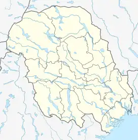
 Portør Location of the village  Portør Portør (Norway) | |
| Coordinates: 58°48′21″N 9°25′58″E / 58.8057°N 9.43288°E | |
| Country | Norway |
| Region | Eastern Norway |
| County | Vestfold og Telemark |
| District | Vestmar |
| Municipality | Kragerø Municipality |
| Elevation | 5 m (16 ft) |
| Time zone | UTC+01:00 (CET) |
| • Summer (DST) | UTC+02:00 (CEST) |
| Post Code | 3788 Stabbestad |
Portør is a village in Kragerø Municipality in Vestfold og Telemark county, Norway. The village is located on the southern Skaggerak coast of the municipality, about 7 kilometres (4.3 mi) straight south of the town of Kragerø. The Jomfruland National Park lies just off shore from Portør.[2]
The Stølefjorden inlet extends inland just north of Portør. Until the mid-1960s, Portør harbor had a pilot station and customs station. Today, the village has a small harbor surrounded by old buildings. Norwegian county road 254 runs from Portør to the village of Levang where it meets Norwegian county road 351.[3][2]

View of the sea just off shore of Portør
In 1137, Portør was the base for Sigurd Slembe's Viking expeditions, until he himself was taken by surprise here and had to flee.[2]
References
- ↑ "Portør, Kragerø". yr.no. Retrieved 9 September 2023.
- 1 2 3 Thorsnæs, Geir, ed. (11 July 2023). "Portør". Store norske leksikon (in Norwegian). Kunnskapsforlaget. Retrieved 9 September 2023.
- ↑ "Portør and Levang" (in Norwegian). Reisemål Kragerø.
This article is issued from Wikipedia. The text is licensed under Creative Commons - Attribution - Sharealike. Additional terms may apply for the media files.