The Countries Portal

The marked territories on this global map are mostly of countries which are sovereign states with full international recognition (brackets denote the country of a marked territory that is not a sovereign state). Some territories are countries in their own right but are not recognized as such (e.g. Taiwan), and some few marked territories are disputed about which country they belong to (e.g. Kashmir) or if they are countries in their own right (e.g. Western Sahara (territory) or the state known by the same name).

A country is a distinct part of the world, such as a state, nation, or other political entity. It may be a sovereign state or make up one part of a larger state. For example, the country of Japan is an independent, sovereign state, while the countries of England, Scotland and Wales are components of a multi-part sovereign state, the United Kingdom. A country may be a historically sovereign area (such as Korea), a currently sovereign territory with a unified government (such as Senegal), or a non-sovereign geographic region associated with certain distinct political, ethnic, or cultural characteristics (such as the Basque Country).

The definition and usage of the word "country" is flexible and has changed over time. The Economist wrote in 2010 that "any attempt to find a clear definition of a country soon runs into a thicket of exceptions and anomalies." Most sovereign states, but not all countries, are members of the United Nations. Countries are often associated with symbols such as flags or anthems; they may also evoke strong feelings of devotion and patriotism in their populations.

The largest country by area is Russia, while the smallest is the microstate Vatican City. The most populous is India; Vatican City is the least populous. (Full article...)

Recognized articles -

Entries here consist of Good and Featured articles, which meet a core set of high editorial standards.

Cameroon (/ˌkæməˈrn/ CAM-ə-ROON; French: Cameroun), officially the Republic of Cameroon (French: République du Cameroun), is a country in Central Africa. It shares boundaries with Nigeria to the west and north, Chad to the northeast, the Central African Republic to the east, and Equatorial Guinea, Gabon and the Republic of the Congo to the south. Its coastline lies on the Bight of Biafra, part of the Gulf of Guinea and the Atlantic Ocean. Due to its strategic position at the crossroads between West Africa and Central Africa, it has been categorized as being in both camps. Its nearly 27 million people speak 250 native languages, in addition to the national tongues of English and French, or both.

Early inhabitants of the territory included the Sao civilisation around Lake Chad, and the Baka hunter-gatherers in the southeastern rainforest. Portuguese explorers reached the coast in the 15th century and named the area Rio dos Camarões (Shrimp River), which became Cameroon in English. Fulani soldiers founded the Adamawa Emirate in the north in the 19th century, and various ethnic groups of the west and northwest established powerful chiefdoms and fondoms. (Full article...)

Selected articles to understand countries -

A world map on the Winkel tripel projection,
a low-error map projection adopted by the National Geographic Society for reference maps

A world map is a map of most or all of the surface of Earth. World maps, because of their scale, must deal with the problem of projection. Maps rendered in two dimensions by necessity distort the display of the three-dimensional surface of the Earth. While this is true of any map, these distortions reach extremes in a world map. Many techniques have been developed to present world maps that address diverse technical and aesthetic goals.

Charting a world map requires global knowledge of the Earth, its oceans, and its continents. From prehistory through the Middle ages, creating an accurate world map would have been impossible because less than half of Earth's coastlines and only a small fraction of its continental interiors were known to any culture. With exploration that began during the European Renaissance, knowledge of the Earth's surface accumulated rapidly, such that most of the world's coastlines had been mapped, at least roughly, by the mid-1700s and the continental interiors by the twentieth century. (Full article...)
List of selected articles to understand countries

General images -

The following are images from various country-related articles on Wikipedia.

Did you know...

Countries of the world -

Remaining countries not listed in the Recognized articles section at left are displayed here.

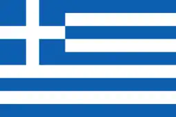
Greece, officially the Hellenic Republic, is a country in Southeast Europe, located on the southern tip of the Balkan peninsula. Greece shares land borders with Albania to the northwest, North Macedonia and Bulgaria to the north, and Turkey to the east. The Aegean Sea lies to the east of the mainland, the Ionian Sea to the west, and the Sea of Crete and the Mediterranean Sea to the south. Greece has the longest coastline on the Mediterranean Basin, featuring thousands of islands. It has a population of nearly 10.5 million (as of 2022). Athens is the nation's capital and the largest city, followed by Thessaloniki and Patras.

Greece is considered the cradle of Western civilization, being the birthplace of democracy, Western philosophy, Western literature, historiography, political science, major scientific and mathematical principles, theatre, and the Olympic Games. From the eighth century BC, the Greeks were organised into various independent city-states, known as poleis (singular polis), which spanned the Mediterranean and the Black Sea. Philip II of Macedon united most of present-day Greece in the fourth century BC, with his son Alexander the Great rapidly conquering much of the known ancient world, from the eastern Mediterranean to northwestern India. The subsequent Hellenistic period saw the height of Greek culture and influence in antiquity. Greece was annexed by Rome in the second century BC, becoming an integral part of the Roman Empire and its continuation, the Byzantine Empire, which was predominantly Greek in culture and language. The Greek Orthodox Church, which emerged in the first century AD, helped shape modern Greek identity and transmitted Greek traditions to the wider Orthodox world. After the Fourth Crusade in 1204, Latin possessions were established in parts of the Greek peninsula, but most of the area fell under Ottoman rule in the mid-15th century. Greece emerged as a modern nation state in 1830, following a war of independence. (Full article...)
List of countries
This following country-related article is a most visited articles of WikiProject Countries, See complete list at Wikipedia:WikiProject Countries/Popular pages.

Need help?

Do you have a question about country-related information that you can't find the answer to? Consider asking it at the Wikipedia reference desk.

WikiProject

For editor resources and to collaborate with other editors on improving Wikipedia's country-related articles, see WikiProject Countries.

Topics

Categories

Category puzzle
Category puzzle
Select [►] to view subcategories
Countries
Countries by continent
Countries by form of government
Countries by international organization
Countries by status
Categories by country
Outlines of countries
Lists of countries
Works about countries
City-states
Country classifications
Country codes
Country lockdowns
Dependent territories
Former countries
Island countries
Landlocked countries
Country names
Proposed countries
Republics
Wikipedia categories named after countries

Country portals

Associated Wikimedia

The following Wikimedia Foundation sister projects provide more on this subject:

External media

Discover Wikipedia using portals

This article is issued from Wikipedia. The text is licensed under Creative Commons - Attribution - Sharealike. Additional terms may apply for the media files.