Porteirão | |
|---|---|
 Coat of arms | |
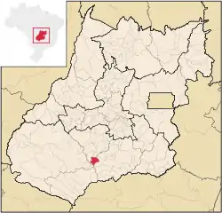
 Location in Goiás state | |
 Porteirão Location in Brazil | |
| Coordinates: 17°49′10″S 50°08′34″W / 17.81944°S 50.14278°W | |
| Country | Brazil |
| Region | Central-West |
| State | Goiás |
| Microregion | Meia Ponte Microregion |
| Area | |
| • Total | 603.9 km2 (233.2 sq mi) |
| Elevation | 470 m (1,540 ft) |
| Population (2020 [1]) | |
| • Total | 3,931 |
| • Density | 6.5/km2 (17/sq mi) |
| Time zone | UTC−3 (BRT) |
| Postal code | 75603-000 |
Porteirão is a municipality in south Goiás state, Brazil.
Geographical Information
Porteirão is located in the Meia Ponte Microregion in the Rio dos Bois basin. It is connected by a state highway (27 km.) with the BR-452 highway, which connects Rio Verde with Itumbiara.
The distance to the state capital, Goiânia, is 178 km. Highway connections from Goiânia are made by GO-040 / Aragoiânia / Cromínia / GO-319 / Pontalina / GO-040 / Aloândia / BR-452 / Bom Jesus de Goiás / GO-410. For the complete list of all distances in Goiás see Seplan
Neighboring municipalities are:
- north: Acreúna
- south: Goiatuba
- east: Vicentópolis and Goiatuba
- west: Santa Helena de Goiás
Political Information
- Mayor: Pedro Augusto dos Reis (January 2005 to January 2009)
Demographics
- Population density: 4.98 inhabitants/km2 (2007)
- Urban population: 2,726(2007)
- Rural population: 282 (2007)
- Population growth or loss: 0.91% from 2000/2007
The economy
The economy is based on agriculture, cattle raising, services, public administration, and small transformation industries.
- Industrial units: 2 (2006)
- Commercial units: 45 (2006)
- Cattle herd: 24,280 head (2006)
- Main crops (2006): cotton, rice, sugarcane (13,000 hectares), beans, soybeans (18,000 hectares), sorghum, and corn.
- People employed in agriculture: 1,670
- Number of farming establishments: 43
- Area of the farming establishments: 27,367 ha.
- Area in planted crops: 17,500 ha.
- Farming establishments with tractors: 14
Education (2006)
- Schools: 2 with 821 students
- Higher education: none
- Adult literacy rate: 80.4% (2000) (national average was 86.4%)
Health (2007)
- Hospitals: 0
- Hospital beds: 0
- Ambulatory clinics: 1
- Infant mortality rate: 27.9 (2000) (national average was 33.0).
Qualtity of Life
The municipality achieved a score of 0.724 on the United Nations Human Development Index (2000), ranking it 162 out of 242 municipalities in the state of Goiás. For the complete list see Frigoletto.com
