Pouembout | |
|---|---|
 Traditional architecture in Pouembout | |
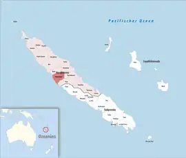
 Location of the commune (in red) within New Caledonia | |
Location of Pouembout | |
| Coordinates: 21°07′40″S 164°53′18″E / 21.1279°S 164.8883°E | |
| Country | France |
| Sui generis collectivity | New Caledonia |
| Province | North Province |
| Government | |
| • Mayor (2020–2026) | Yann Peraldi[1] |
| Area 1 | 674.3 km2 (260.3 sq mi) |
| Population (2019 census)[2] | 2,752 |
| • Density | 4.1/km2 (11/sq mi) |
| Ethnic distribution | |
| • 2019 census | Kanaks 36.41% Europeans 26.34% Wallisians and Futunans 1.82% Mixed 18.13% Other 17.3% |
| Time zone | UTC+11:00 |
| INSEE/Postal code | 98825 /98825 |
| Elevation | 0–1,134 m (0–3,720 ft) (avg. 10 m or 33 ft) |
| 1 New Caledonia Land Register (DITTT) data, which exclude lakes and ponds larger than 1 km² (0.386 sq mi or 247 acres) as well as the estuaries of rivers. | |
Pouembout is a commune in the North Province of New Caledonia, an overseas territory of France in the Pacific Ocean.
Geography
Climate
Pouembout has a tropical savanna climate (Köppen climate classification Aw). The average annual temperature in Pouembout is 23.5 °C (74.3 °F). The average annual rainfall is 1,002.6 mm (39.47 in) with January as the wettest month. The temperatures are highest on average in February, at around 27.0 °C (80.6 °F), and lowest in July, at around 19.6 °C (67.3 °F). The highest temperature ever recorded in Pouembout was 37.9 °C (100.2 °F) on 19 November 1968; the coldest temperature ever recorded was 6.0 °C (42.8 °F) on 26 July 1970.
| Climate data for Pouembout (1981–2010 averages, extremes 1962−2009) | |||||||||||||
|---|---|---|---|---|---|---|---|---|---|---|---|---|---|
| Month | Jan | Feb | Mar | Apr | May | Jun | Jul | Aug | Sep | Oct | Nov | Dec | Year |
| Record high °C (°F) | 37.3 (99.1) |
37.3 (99.1) |
35.5 (95.9) |
34.0 (93.2) |
34.1 (93.4) |
32.9 (91.2) |
31.1 (88.0) |
32.0 (89.6) |
34.3 (93.7) |
34.6 (94.3) |
37.9 (100.2) |
37.1 (98.8) |
37.9 (100.2) |
| Mean daily maximum °C (°F) | 31.9 (89.4) |
31.8 (89.2) |
31.1 (88.0) |
29.8 (85.6) |
28.0 (82.4) |
26.2 (79.2) |
25.2 (77.4) |
25.6 (78.1) |
27.3 (81.1) |
29.1 (84.4) |
30.3 (86.5) |
31.4 (88.5) |
29.0 (84.2) |
| Daily mean °C (°F) | 26.8 (80.2) |
27.0 (80.6) |
26.2 (79.2) |
24.7 (76.5) |
22.7 (72.9) |
20.9 (69.6) |
19.6 (67.3) |
19.8 (67.6) |
21.1 (70.0) |
23.0 (73.4) |
24.5 (76.1) |
25.9 (78.6) |
23.5 (74.3) |
| Mean daily minimum °C (°F) | 21.7 (71.1) |
22.1 (71.8) |
21.4 (70.5) |
19.5 (67.1) |
17.5 (63.5) |
15.7 (60.3) |
14.0 (57.2) |
14.0 (57.2) |
14.8 (58.6) |
16.8 (62.2) |
18.8 (65.8) |
20.4 (68.7) |
18.0 (64.4) |
| Record low °C (°F) | 14.0 (57.2) |
13.6 (56.5) |
12.0 (53.6) |
10.1 (50.2) |
8.5 (47.3) |
6.5 (43.7) |
6.0 (42.8) |
6.5 (43.7) |
7.5 (45.5) |
6.2 (43.2) |
11.0 (51.8) |
11.0 (51.8) |
6.0 (42.8) |
| Average precipitation mm (inches) | 158.4 (6.24) |
156.9 (6.18) |
157.4 (6.20) |
68.7 (2.70) |
72.1 (2.84) |
67.8 (2.67) |
48.7 (1.92) |
44.2 (1.74) |
29.3 (1.15) |
32.3 (1.27) |
58.1 (2.29) |
108.7 (4.28) |
1,002.6 (39.47) |
| Average precipitation days (≥ 1.0 mm) | 9.2 | 10.7 | 11.0 | 6.6 | 5.9 | 6.5 | 5.3 | 4.9 | 3.1 | 3.8 | 5.4 | 7.8 | 80.3 |
| Source: Meteociel[3] | |||||||||||||
References
- ↑ "Répertoire national des élus: les maires" (in French). data.gouv.fr, Plateforme ouverte des données publiques françaises. 13 September 2022.
- ↑ Population, ménages et logement par commune, en 2019, Institut de la statistique et des études économiques Nouvelle-Calédonie
- ↑ "Normales et records pour Pouembout (988)". Meteociel. Retrieved 3 June 2022.
Wikimedia Commons has media related to Pouembout.
This article is issued from Wikipedia. The text is licensed under Creative Commons - Attribution - Sharealike. Additional terms may apply for the media files.