Qadam
ٱلْقَدَم al-Kadam, Kadam | |
|---|---|
Municipality | |
| Arab transcription(s) | |
| • English | "The foot" |
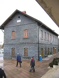 Main CFS train station in Qadam | |
 Al-Qadam depicted as Al-Kadam on a map of the municipalities of Damascus | |
| Coordinates: 33°28′00″N 36°17′00″E / 33.46667°N 36.28333°E | |
| Country | |
| Governorate | Damascus Governorate |
| City | Damascus |
| Population (2004) | |
| • Total | 95,944[1] |
| Time zone | UTC+3 (EET) |
| • Summer (DST) | UTC+2 (EEST) |
| Climate | BSk |
Qadam (Arabic: ٱلْقَدَم, romanized: al-Qadam) is a municipality and a neighborhood in the southern part of Damascus, Syria,[2] due west of Yarmouk Camp.
History
Prior to its urbanization and integration into Damascus municipality al-Qadam was a village on the Hajj caravan road called al-Qadam al-Sharif (the Noble Foot).[3] It was named after a stone originally from Bosra where tradition holds an imprint was left of the foot of the Islamic prophet Muhammad when he visited the city.[3] The stone had been relocated from Bosra to a mosque in al-Qadam.[3]
Districts
References
- 1 2 "Syrian Arab Republic Damascus Governorate Reference map" (PDF). ReliefWeb. United Nations Office for the Coordination of Humanitarian Affairs. 2015-03-16. Retrieved 2016-04-08.
- ↑ Khaled Yacoub Oweis (2012-07-18). "Battles break out near Syrian presidential palace". Reuters. Retrieved 2012-07-19.
- 1 2 3 Munayyir, Muhammad Arif ibn Ahmad (1971). Landau, Jacob M. (ed.). The Hejaz Railway and the Muslim Pilgrimage: A Case of Ottoman Political Propaganda. Wayne State University Press. ISBN 9780814314227.
This article is issued from Wikipedia. The text is licensed under Creative Commons - Attribution - Sharealike. Additional terms may apply for the media files.