Ramena
Amoronjia-Orangéa | |
|---|---|
 | |
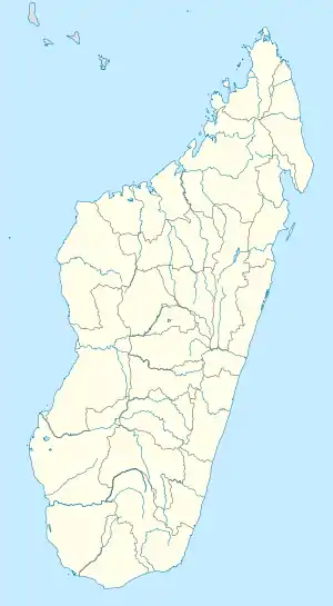 Ramena Location in Madagascar | |
| Coordinates: 12°14′S 49°21′E / 12.233°S 49.350°E | |
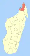
| Country | |
| Region | Diana |
| District | Antsiranana II |
| Area | |
| • Total | 105 km2 (41 sq mi) |
| Elevation | 44 m (144 ft) |
| Population (2020) | |
| • Total | 11,521 |
| • Ethnicities density | 110/km2 (300/sq mi) |
| Time zone | UTC3 (EAT) |
| Postal code | 202 |
Ramena is a rural municipality and a beach village in Madagascar. It belongs to the district of Antsiranana II, which is a part of Diana Region. The population of the municipality was 11521 in 2020. Only primary schooling is available.
Ramena is also the most popular beach of Diego Suarez from which it can be reached by an asphalted road in a distance of 18 km.
Economy
Fishing, tourism, commerce & agriculture.
Villages (Fokontany)
The villages of Ramena, Ankorikahely, Ivovona, Andavakoera and Betahitra belong to the municipality. The seat & main locality is Ramena. Only Ramena and Ankorikahely are connected to the Jirama electric grid.
Roads
The paved National road 59b leads to Antsiranana (Diego Suraez - 18 km).
Bodies of Water
The Betahitra River and the Antsivorahana Lake.
Localities
- Montagne des Français
- Ampombiantambo
- Nosy Lonjo
References and notes
- ↑ Monographie Ramena
- ↑ Estimated based on DEM data from Shuttle Radar Topography Mission
| Ambanja (24) - 203 |
|  |
|---|---|---|
| Ambilobe (15) - 204 | ||
| Antsiranana (Diego Suarez) (1) - 201 | ||
| Antsiranana II (22) - 202 |
| |
| Nosy Be (5) - 207 |
| |
5 districts; 51 communes | ||
12°14′S 49°21′E / 12.233°S 49.350°E