Ramsay | |
|---|---|
Neighbourhood | |
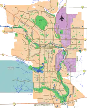
 Ramsay Location of Ramsay in Calgary | |
| Coordinates: 51°02′11″N 114°02′38″W / 51.03639°N 114.04389°W | |
| Country | |
| Province | |
| City | |
| Quadrant | SE |
| Ward | 9 |
| Established | 1914 |
| Government | |
| • Mayor | Jyoti Gondek |
| • Administrative body | Calgary City Council |
| • Councillor | Gian-Carlo Carra |
| Area | |
| • Total | 0.9 km2 (0.3 sq mi) |
| Elevation | 1,065 m (3,494 ft) |
| Population (2006)[2] | |
| • Total | 2,039 |
| • Median Income (2000) | $43,716 |
| Time zone | UTC-7 (Mountain Time Zone) |
| Area code | area code 403 |
| Website | Ramsay Community Association |
Ramsay is a residential neighbourhood in the southeast quadrant of Calgary, Alberta. It is an inner city community, located east of the Elbow River, Macleod Trail, Stampede Grounds and the Scotiabank Saddledome arena and south of Inglewood. To the southeast, it borders the Alyth-Bonny Brook industrial area. The eastern half of the community consists primarily of older homes and there is an industrial area in the most eastern corner of the community.[3]
The area now known as Ramsay was developed in the 1880s by Wesley Fletcher Orr and his partners. It was named Ramsay in 1956 when residents of Burnsland, Brewery Flats, Grandview and Mills Estate consolidated as a new community. It was named for William Thomson Ramsay (1857-1921), an early land agent and property owner. It is represented in the Calgary City Council by the Ward 9 councillor. The community has an area redevelopment plan in place.[4]
In 2020, Calgary City Council approved the construction of Inglewood/Ramsay Station, part of the Calgary Green Line. The station will be elevated over 12 Street SE alongside the freight tracks, near the intersection of 11 Avenue SE / 12 Street SE. Construction will begin early 2021.[5]
Demographics
In the City of Calgary's 2012 municipal census, Ramsay had a population of 2,110 living in 1,132 dwellings, a 5.2% increase from its 2011 population of 2,006.[6] With a land area of 1 km2 (0.39 sq mi), it had a population density of 2,100/km2 (5,500/sq mi) in 2012.[6][7]
Residents in this community had a median household income of $43,716 in 2000. As a reference, the median household income for the whole city of Calgary was approximately 30% greater: $57,879.[8]
The low income residents living in the neighbourhood represented 19.5% of its total population.[8] As of 2000, 15.1% of the residents were immigrants. A proportion of 31% of the buildings were condominiums or apartments, and 46.9% of the housing was used for renting.[2]
Education
The community is served by the Ecole Ste. Anne Elementary,[9] Junior & Senior (Calgary Catholic School District),[10] Ramsay Elementary public school[11] and Janus Academy,[12] a private school for children and youth with Autism Spectrum Disorder.
See also
References
- ↑ "Calgary Elections". City of Calgary. 2017. Retrieved November 12, 2017.
- 1 2 City of Calgary (2006). "Ramsay Community Statistics" (PDF). Retrieved 2007-05-09.
- ↑ "Federation of Calgary Communities". Retrieved 2007-07-15.
- ↑ City of Calgary Planning (2005). "Ramsay Area Redevelopment Plan" (PDF). Retrieved 2007-05-11.
- ↑ "Calgary council votes to build the $5.5B Green Line".
- 1 2 "2012 Civic Census Results" (PDF). City of Calgary. 2012. Retrieved February 4, 2013.
- ↑ "Community Boundaries" (Esri shapefile). City of Calgary. Retrieved February 5, 2013.
- 1 2 City of Calgary (2004). "Ward 9 Profile" (PDF). Archived from the original (PDF) on 2010-07-05. Retrieved 2007-05-09.
- ↑ St. Anne Academic Centre
- ↑ Calgary Catholic School District
- ↑ Ramsay Elementary School
- ↑ "Home". janusacademy.org.