| Randolph Brook | |
|---|---|
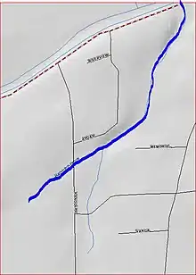 Map of Randolph Brook | |
| Location | |
| Country | United States |
| Physical characteristics | |
| Source | |
| • coordinates | 40°32′6″N 74°33′38″W / 40.53500°N 74.56056°W |
| Mouth | |
• coordinates | 40°33′3″N 74°32′53″W / 40.55083°N 74.54806°W |
• elevation | 20 ft (6.1 m) |
| Basin features | |
| Progression | Millstone River, Raritan River, Atlantic Ocean |
| River system | Raritan River system |
Randolph Brook is a tributary of the Millstone River in northern Franklin Park, New Jersey, United States.
Course
Randolph Brook starts at 40°32′6″N 74°33′38″W / 40.53500°N 74.56056°W,[1] near Randolph Road. It crosses Randolph Road and Westons Canal Road before flowing under the Delaware and Raritan Canal and draining into the Millstone River at 40°33′3″N 74°32′53″W / 40.55083°N 74.54806°W.[1]
See also
References
- 1 2 "GNIS Detail - Randolph Brook". USGS. Retrieved 23 July 2010.
External links
This article is issued from Wikipedia. The text is licensed under Creative Commons - Attribution - Sharealike. Additional terms may apply for the media files.