| Reeth Bay | |
|---|---|
 Reeth Bay | |
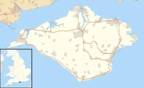 Reeth Bay Location within the Isle of Wight | |
| Civil parish |
|
| Ceremonial county | |
| Region | |
| Country | England |
| Sovereign state | United Kingdom |
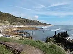
Reeth Bay is a small curved bay on the southernmost tip of the Isle of Wight, England. It lies to the south of the village of Niton with a 1⁄4-mile-long (0.4 km) shoreline.[1] It faces south out into the English Channel and lies to the east of St. Catherine's Point lighthouse. It is at the centre of a small hamlet called Castlehaven where there is a concrete ramp for launching small craft.[2] The beach is predominantly sand and pebbles. The seabed is a mixture of rocks and mud. The bay is best accessed from the road from Niton that leads down to the bay.
History
There is a 19th-century lifeguard cottage at the bay.[3] The bay used to be a popular tourist destination and had bathing machines during the Victorian era.[2] There also used to be an east-facing slip at Puckaster for fishing boats.
References
- ↑ Google (14 December 2018). "Reeth Bay" (Map). Google Maps. Google. Retrieved 14 December 2018.
- 1 2 Peter Bruce (May 2008). Wight Hazards. Boldre Marine. p. 44. ISBN 978-1-871680-51-5.
- ↑ Historic Environment Action Plan The Undercliff