Rembercourt-Sommaisne | |
|---|---|
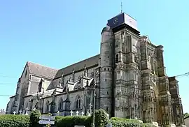 Saint-Louvent church | |
.svg.png.webp) Coat of arms | |
Location of Rembercourt-Sommaisne | |
 Rembercourt-Sommaisne 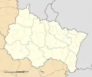 Rembercourt-Sommaisne | |
| Coordinates: 48°54′40″N 5°10′44″E / 48.9111°N 5.1789°E | |
| Country | France |
| Region | Grand Est |
| Department | Meuse |
| Arrondissement | Bar-le-Duc |
| Canton | Revigny-sur-Ornain |
| Intercommunality | CC de l'Aire à l'Argonne |
| Government | |
| • Mayor (2020–2026) | Sylvain Obara[1] |
| Area 1 | 22.32 km2 (8.62 sq mi) |
| Population | 315 |
| • Density | 14/km2 (37/sq mi) |
| Time zone | UTC+01:00 (CET) |
| • Summer (DST) | UTC+02:00 (CEST) |
| INSEE/Postal code | 55423 /55250 |
| Elevation | 223–307 m (732–1,007 ft) |
| 1 French Land Register data, which excludes lakes, ponds, glaciers > 1 km2 (0.386 sq mi or 247 acres) and river estuaries. | |
Rembercourt-Sommaisne (French pronunciation: [ʁɑ̃bɛʁkuʁ sɔmɛn]) is a commune in the Meuse department in Grand Est in northeastern France.
Rembercourt-Sommaisne was created on 1 January 1973 when the former communes of Rembercourt-aux-Pots and Sommaisne were joined. The 15th century church of Saint-Louvent in Rembercourt-aux-Pots is a listed monument.[3]
Geography
The Chée forms part of the commune's southern border.
The Aisne rises near Sommaisne, a hamlet in the northern part of the commune.
See also
References
- ↑ "Répertoire national des élus: les maires" (in French). data.gouv.fr, Plateforme ouverte des données publiques françaises. 13 September 2022.
- ↑ "Populations légales 2021". The National Institute of Statistics and Economic Studies. 28 December 2023.
- ↑ Base Mérimée: Eglise de Rembercourt, Ministère français de la Culture. (in French)
Wikimedia Commons has media related to Rembercourt-Sommaisne.
This article is issued from Wikipedia. The text is licensed under Creative Commons - Attribution - Sharealike. Additional terms may apply for the media files.