| Ripuk | |
|---|---|
 | |
| Geography | |
| Location | Nepal, Province No. 1, Sankhuwasabha District |
| Coordinates | 27°47′27″N 87°08′31″E / 27.79083°N 87.14194°E |
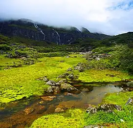
Ripuk (रिपुक) is a local name for one of the highland pastures in Barun Valley where locals set up their temporary seasonal settlements.
Centuries ago, the river Barun used to be a glacier there, flowing to the north composing this lush green valley for today.
See also
This article is issued from Wikipedia. The text is licensed under Creative Commons - Attribution - Sharealike. Additional terms may apply for the media files.