स्वागतम् / Welcome to the Nepal Portal
Mount Everest,Koshi,Nepal


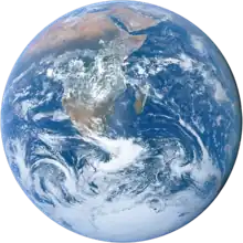
Location on the world map

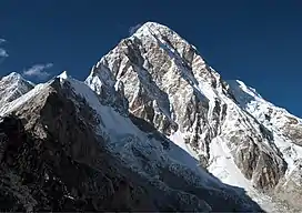
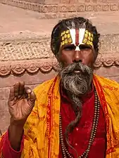
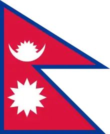
Nepal, officially the Federal Democratic Republic of Nepal, is a landlocked country in South Asia. It is mainly situated in the Himalayas, but also includes parts of the Indo-Gangetic Plain. It borders the Tibet Autonomous Region of China to the north, and India to the south, east, and west, while it is narrowly separated from Bangladesh by the Siliguri Corridor, and from Bhutan by the Indian state of Sikkim. Nepal has a diverse geography, including fertile plains, subalpine forested hills, and eight of the world's ten tallest mountains, including Mount Everest, the highest point on Earth. Kathmandu is the nation's capital and the largest city. Nepal is a multi-ethnic, multi-lingual, multi-religious and multi-cultural state, with Nepali as the official language.

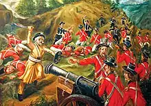
The name "Nepal" is first recorded in texts from the Vedic period of the Indian subcontinent, the era in ancient Nepal when Hinduism was founded, the predominant religion of the country. In the middle of the first millennium BC, Gautama Buddha, the founder of Buddhism, was born in Lumbini in southern Nepal. Parts of northern Nepal were intertwined with the culture of Tibet. The centrally located Kathmandu Valley is intertwined with the culture of Indo-Aryans, and was the seat of the prosperous Newar confederacy known as Nepal Mandala. The Himalayan branch of the ancient Silk Road was dominated by the valley's traders. The cosmopolitan region developed distinct traditional art and architecture. By the 18th century, the Gorkha Kingdom achieved the unification of Nepal. The Shah dynasty established the Kingdom of Nepal and later formed an alliance with the British Empire, under its Rana dynasty of premiers. The country was never colonised but served as a buffer state between Imperial China and British India. Parliamentary democracy was introduced in 1951 but was twice suspended by Nepalese monarchs, in 1960 and 2005. The Nepalese Civil War in the 1990s and early 2000s resulted in the establishment of a secular republic in 2008, ending the world's last Hindu monarchy.

The Constitution of Nepal, adopted in 2015, affirms the country as a secular federal parliamentary republic divided into seven provinces. Nepal was admitted to the United Nations in 1955, and friendship treaties were signed with India in 1950 and China in 1960. Nepal hosts the permanent secretariat of the South Asian Association for Regional Cooperation (SAARC), of which it is a founding member. Nepal is also a member of the Non-Aligned Movement and the Bay of Bengal Initiative. The Nepalese Armed Forces are the fifth-largest in South Asia; and are notable for their Gurkha history, particularly during the world wars, and has been a significant contributor to United Nations peacekeeping operations. (Full article...)

More Did you know (auto generated)

Selected article -

Damaged homes in Kathmandu after the April mainshock.

The April 2015 Nepal earthquake (also known as the Gorkha earthquake) killed 8,964 people and injured 21,952 more. It occurred at on Saturday, 25 April 2015, with a magnitude of 7.8Mw or 8.1Ms and a maximum Mercalli Intensity of X (Extreme). Its epicenter was east of Gorkha District at Barpak, Gorkha, roughly 85 km (53 mi) northwest of central Kathmandu, and its hypocenter was at a depth of approximately 8.2 km (5.1 mi). It was the worst natural disaster to strike Nepal since the 1934 Nepal–Bihar earthquake. The ground motion recorded in Kathmandu, the capital of Nepal, was of low frequency, which, along with its occurrence at an hour when many people in rural areas were working outdoors, decreased the loss of property and human lives.

The earthquake triggered an avalanche on Mount Everest, killing 22 people, the deadliest incident on the mountain on record. The earthquake triggered another huge avalanche in the Langtang valley, where 250 people were reported missing. (Full article...)

Good article -

This is a Good article, an article that meets a core set of high editorial standards.

Pashupatinath Temple in 2020

The Pashupatinath Temple (Nepali: पशुपतिनाथ मन्दिर) is a Hindu temple dedicated to Pashupati, a form of Shiva, and is located in Kathmandu, Nepal near the Bagmati River. This temple was classified as a World Heritage Site in 1979. This "extensive Hindu temple precinct" is a "sprawling collection of temples, ashrams, images and inscriptions raised over the centuries along the banks of the sacred Bagmati river", and is one of seven monument groups in UNESCO's designation of Kathmandu Valley. It is built on an area of 246 hectares (2,460,000 m2) and includes 518 mini-temples and a main pagoda house.

The temple is one of the Paadal Petra Sthalams on the continent. (Full article...)

Selected picture -

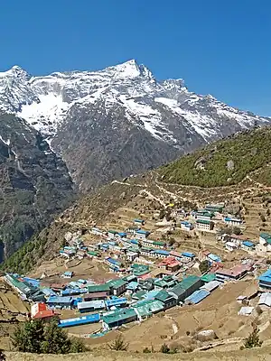
Namche Bazaar is a town in Khumbu Pasanglhamu Rural Municipality in Solukhumbu District of Province No. 1 of north-eastern Nepal. It is located within the Khumbu area at 3,440 metres (11,286 ft) at its low point, populating the sides of a hill. Most Sherpa who are in the tourism business are from the Namche area. Namche is the main trading center and hub for the Khumbu region with many Nepalese officials.


Categories

Category puzzle
Category puzzle
Select [►] to view subcategories
Nepal
Districts of Nepal
Provinces of Nepal
Nepal-related lists
Buildings and structures in Nepal
Nepalese culture
Economy of Nepal
Education in Nepal
Elephants in Nepal
Environment of Nepal
Firefighting in Nepal
Geography of Nepal
Government of Nepal
Health in Nepal
History of Nepal
Maps of Nepal
Nepal Studies
Organisations based in Nepal
Nepalese people
Politics of Nepal
Society of Nepal
Tharu culture
Images of Nepal
Nepal stubs

Selected biography -

Shailaja Acharya (Nepali: शैलजा आचार्य) (1944 – 12 June 2009) was a Nepali revolutionary, politician and diplomat. She served as The Prime Minister of Nepal for three months in 1998 , She also was the first Nepali woman to be elected as the Deputy Prime Minister of Nepal

A member of the influential Koirala family, Acharya entered active politics as a student, and was held political prisoner for three years as a teenager, after she showed a black flag to King Mahendra in protest of coup d'état by the monarchy against the democratically elected government in 1961. Upon release, she went into self-exile in India where she fostered a close friendship with Indian leaders, notably Chandra Sekhar, while she continued to advance the democratic struggle against the Panchayat System. She played an instrumental role in organising the youth movement, collecting and smuggling arms and ammunition for a possible armed conflict and publishing a paper to raise political awareness. She accompanied BP Koirala when the latter returned to Nepal and was immediately arrested upon arrival. She spent a total of five years in jail during the Panchayat regime. (Full article...)

Selected fare or cuisine -

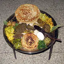
"Lāgwa" meatball (center right) and "lāpi" meat patty (center left) on a large ceremonial plate.
Chunlā (Newar: चुंला, "ground meat") is a traditional meat dish of the Kathmandu Valley in Nepal. It is meat finely chopped by a chopping knife or meat grinder. Chunlā is a popular dish in Newar cuisine and is similar to Qeema found in other parts of South Asia. (Full article...)

Did you know -

  • The word Himalaya means the home or abode of snow.
  • The geological age of the Himalaya is approximately 70 million years.
  • Himalayan rivers are older than the Himalayan peaks.

Wiki Loves Nepal
The following pages at Wikimedia Commons contain a plethora of images taken in Nepal.
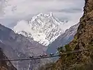
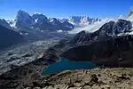
Suspension bridge over he Kali Gandaki river near Tatopani.: Wiki Loves Earth 2017 3rd Price Winner Gokyo Lakes This image won the 2nd prize in the national contest of Nepal in Wiki Loves Earth 2017: Sunrise near Samagauon village – Manaslu trek area.

Wiki Loves Earth is an international photographic competition to promote natural heritage sites around the World through Wikimedia projects (mainly Wikipedia and Wikimedia Commons).


Wiki Loves Monuments is an international photographic competition to promote cultural monuments around the World through Wikimedia projects (mainly Wikipedia and Wikimedia Commons.

Provinces

Below is a clickable map of Nepal's Provinces

Topics


Indian Subcontinent


Other countries

Recognized content

Extended content

Good articles

Associated Wikimedia

The following Wikimedia Foundation sister projects provide more on this subject:

Discover Wikipedia using portals
This article is issued from Wikipedia. The text is licensed under Creative Commons - Attribution - Sharealike. Additional terms may apply for the media files.