Riverside-Albert | |
|---|---|
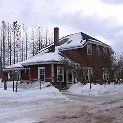
 Former train station in Riverside-Albert | |
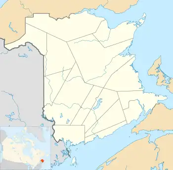
 Riverside-Albert Location of Riverside-Albert, New Brunswick | |
| Coordinates: 45°45′5.1″N 64°43′3.6″W / 45.751417°N 64.717667°W | |
| Country | Canada |
| Province | New Brunswick |
| County | Albert County |
| Parish | Hopewell Parish |
| Municipality | Fundy Albert |
| Incorporated | 1966 |
| Amalgamated | 2023 |
| Government | |
| • Type | Village council |
| Area | |
| • Land | 3.39 km2 (1.31 sq mi) |
| Population (2021)[1] | |
| • Total | 348 |
| • Density | 102.8/km2 (266/sq mi) |
| • Change (2016–21) | |
| Electoral districts | |
| • Federal | Fundy Royal |
| • Provincial | Albert |
| Time zone | UTC-4 (Atlantic (AST)) |
| • Summer (DST) | UTC-3 (Atlantic (ADT)) |
| Canadian Postal code | |
| Area code(s) | 506, 428 |
| Telephone Exchange | 882 |
| Highway | |
| Website | http://www.riverside-albert.ca |
Riverside-Albert is a former village in Hopewell Parish of Albert County, New Brunswick, Canada. It was an incorporated village until the end of 2022 and is now part of the village of Fundy Albert.
Riverside-Albert is located on the Shepody River at the edge of the Shepody Marsh. The community of Harvey Parish is located across the river. It is approximately halfway between two major tourist destinations: Fundy National Park and the Hopewell Rocks.
Post office called Albert from 1875; Riverside from 1875 to 1932; Riverside from 1932.
The Trans Canada Trail passes through Riverside-Albert.[2]
History
Riverside and Albert both appear as communities on the cadastral land grant map of the area.[3]
Albert was originally called Hopewell Hill but the inhabitants resolved to rename it Albert in 1881 due to there being four communities named Hopewell within 12 miles of each other. In 1898 Albert was the terminus of the Salisbury and Harvey Railway, with a population of 500.[4]
Riverside, originally River Side, was a station on the Salisbury and Hillsborough Railway, with a population of 300 in 1871. The post office was renamed Riverside in 1932.[5]
The local improvement district of Riverside-Albert was incorporated on 29 December 1947.[6] The local improvement district became a village in 1966 under the new Municipalities Act.[7][8]
On 1 January 2023, the village of Riverside-Albert amalgamated with the villages of Alma and Hillsborough and parts of five local service districts to form the new village of Fundy Albert.[9][10] The community's name remains in official use.[11]
Demographics
In the 2021 Census of Population conducted by Statistics Canada, Riverside-Albert had a population of 348 living in 142 of its 154 total private dwellings, a change of -0.6% from its 2016 population of 350. With a land area of 3.39 km2 (1.31 sq mi), it had a population density of 102.7/km2 (265.9/sq mi) in 2021.[1]
Notable people
Notable residents have included Abner Reid McClelan and Roscoe Fillmore.
See also
References
- 1 2 3 "Census Profile of Riverside-Albert, Village (VL)". Statistics Canada. 6 December 2022. Retrieved 21 January 2023.
- ↑ Sentier NB Trails
- ↑ "No. 143". Provincial Archives of New Brunswick. Retrieved 1 April 2023.
- ↑ "Albert". Provincial Archives of New Brunswick. Retrieved 1 April 2023.
- ↑ "Riverside-Albert". Provincial Archives of New Brunswick. Retrieved 1 April 2023.
- ↑ "Local Improvement Districts". The Royal Gazette. 106: 48–49. 4 February 1948.
- ↑ Municipalities Act of 1966, Second Schedule, p. 151.
- ↑ Hamilton, William (1978). The Macmillan Book of Canadian Place Names. Toronto: Macmillan. p. 84. ISBN 0-7715-9754-1.
- ↑ "Local Governments Establishment Regulation – Local Governance Act". Government of New Brunswick. 12 October 2022. Retrieved 21 January 2023.
- ↑ "RSC 7 Southeast Regional Service Commission". Government of New Brunswick. Retrieved 21 January 2023.
- ↑ "Proposed entity names reflect strong ties to nature and history" (Press release). Irishtown, New Brunswick: Government of New Brunswick. 25 May 2022. Retrieved 21 January 2023.
External links