Rivière-Verte | |
|---|---|
Neighbourhood | |
 | |
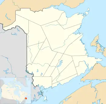
 Rivière-Verte Location within New Brunswick. | |
| Coordinates: 47°19′N 68°09′W / 47.317°N 68.150°W | |
| Country | Canada |
| Province | New Brunswick |
| County | Madawaska |
| Parish | Rivière-Verte |
| City | Edmundston |
| Village Status | 1966 |
| Electoral Districts Federal | Madawaska—Restigouche |
| Provincial | Restigouche-La-Vallée |
| Area | |
| • Land | 6.91 km2 (2.67 sq mi) |
| Population (2021)[1] | |
| • Total | 744 |
| • Density | 107.7/km2 (279/sq mi) |
| • Change (2016–21) | |
| • Dwellings | 373 |
| Time zone | UTC-4 (AST) |
| • Summer (DST) | UTC-3 (ADT) |
| Postal code(s) | |
| Area code | 506 |
| Highways | |
| Website | www |
Rivière-Verte is a neighbourhood in Edmundston. It held village status prior to 2023.
It is 15 kilometres southeast of downtown Edmundston along the Saint John River and the Green River. The Green River's official French name is Rivière Verte,[2] from which the village takes name.
History
On 1 January 2023, Rivière-Verte was annexed by the city of Edmundston.[3] The community's name remains in official use.[4]
Demographics
In the 2021 Census of Population conducted by Statistics Canada, Rivière-Verte had a population of 744 living in 359 of its 373 total private dwellings, a change of 2.8% from its 2016 population of 724. With a land area of 6.91 km2 (2.67 sq mi), it had a population density of 107.7/km2 (278.9/sq mi) in 2021.[1]
Canada census – Rivière-Verte community profile
| 2021 | 2016 | 2011 | |
|---|---|---|---|
| Population | 744 (+2.8% from 2016) | 724 (-2.7% from 2011) | 744 (-6.8% from 2006) |
| Land area | 6.91 km2 (2.67 sq mi) | 6.70 km2 (2.59 sq mi) | 7.00 km2 (2.70 sq mi) |
| Population density | 107.7/km2 (279/sq mi) | 108.0/km2 (280/sq mi) | 106.3/km2 (275/sq mi) |
| Median age | 50.8 (M: 52, F: 50.4) | 50.1 (M: 52.0, F: 48.5) | 48.9 (M: 48.4, F: 49.2) |
| Private dwellings | 360 (total) | 358 (total) | 354 (total) |
| Median household income | $45,440 | $34,297 |
Language
| Canada Census Mother Tongue - Rivière-Verte, New Brunswick[5] | ||||||||||||||||||
|---|---|---|---|---|---|---|---|---|---|---|---|---|---|---|---|---|---|---|
| Census | Total | French |
English |
French & English |
Other | |||||||||||||
| Year | Responses | Count | Trend | Pop % | Count | Trend | Pop % | Count | Trend | Pop % | Count | Trend | Pop % | |||||
2016 |
710 |
680 | 95.8% | 25 | 3.5% | 5 | 0.7% | 0 | 0.00% | |||||||||
2011 |
730 |
710 | 97.26% | 20 | 2.74% | 0 | 0.00% | 0 | 0.00% | |||||||||
2006 |
785 |
755 | 96.18% | 30 | 3.82% | 0 | 0.00% | 0 | 0.00% | |||||||||
2001 |
845 |
815 | 96.45% | 20 | 2.37% | 10 | 1.18% | 0 | 0.00% | |||||||||
1996 |
920 |
895 | n/a | 97.28% | 15 | n/a | 1.63% | 10 | n/a | 1.09% | 0 | n/a | 0.00% | |||||
Notable people
See also
References
- 1 2 3 4 "Census Profile of Rivière-Verte, Village (VL)". Statistics Canada. 6 December 2022. Retrieved 21 January 2023.
- ↑ "Green River / Rivière Verte". Canadian Geographical Names Database (CGNDB). Retrieved 21 January 2023.
- ↑ "Local Governments Establishment Regulation – Local Governance Act". Government of New Brunswick. 12 October 2022. Retrieved 11 January 2023.
- ↑ "Proposed entity names reflect strong ties to nature and history" (Press release). Irishtown, New Brunswick: Government of New Brunswick. 25 May 2022. Retrieved 21 January 2023.
- 1 2 Statistics Canada: 1996, 2001, 2006, 2011 census
- ↑ "Census Profile, 2016 Census Rivière-Verte, Village [Census subdivision], New Brunswick". Statistics Canada. Retrieved September 21, 2019.
- ↑ "2021 Community Profiles". 2021 Canadian Census. Statistics Canada. February 4, 2022. Retrieved 2022-04-27.
- ↑ "2016 Community Profiles". 2016 Canadian Census. Statistics Canada. August 12, 2021. Retrieved 2019-09-21.
- ↑ "2011 Community Profiles". 2011 Canadian Census. Statistics Canada. March 21, 2019. Retrieved 2014-04-19.
- ↑ "2006 Community Profiles". 2006 Canadian Census. Statistics Canada. August 20, 2019.
- ↑ "2001 Community Profiles". 2001 Canadian Census. Statistics Canada. July 18, 2021.
This article is issued from Wikipedia. The text is licensed under Creative Commons - Attribution - Sharealike. Additional terms may apply for the media files.