Rocky Comfort, Missouri | |
|---|---|
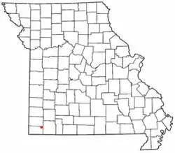
 Location of Rocky Comfort in Missouri | |
| Country | United States |
| State | Missouri |
| County | McDonald |
| Area | |
| • Total | 0.55 sq mi (1.43 km2) |
| • Land | 0.55 sq mi (1.43 km2) |
| • Water | 0.00 sq mi (0.00 km2) |
| Population (2020) | |
| • Total | 176 |
| • Density | 317.69/sq mi (122.70/km2) |
| FIPS code | 29-62822 |
| GNIS feature ID | 725507[2] |
Rocky Comfort[2] is an unincorporated community and census-designated place in northeastern McDonald County, Missouri, United States, on Route 76. It is part of the Fayetteville–Springdale–Rogers, AR-MO Metropolitan Statistical Area.
A post office called Rocky Comfort has been in operation since 1876.[3] Some say the community was named for the rocky terrain in an idyllic setting, while others believe the name is a transfer from Rocky Comfort, Arkansas.[4] The community is mentioned in Dennis Murphy's poem of 1941, The Doomed Race,[5] and is both title and setting for Wayne Holmes' 2009 memoir, Rocky Comfort.[6] From 1902 to 1908, when it moved to nearby Fairview, the Horner Institute, a private school offering courses from the eighth grade through high school, was located in Rocky Comfort.
Demographics
| Census | Pop. | Note | %± |
|---|---|---|---|
| 2020 | 176 | — | |
| U.S. Decennial Census[7] | |||
Notable person
- Travis Phelps, former Major League Baseball pitcher who was born in Rocky Comfort
References
- ↑ "ArcGIS REST Services Directory". United States Census Bureau. Retrieved September 5, 2022.
- 1 2 U.S. Geological Survey Geographic Names Information System: Rocky Comfort, Missouri
- ↑ "Post Offices". Jim Forte Postal History. Retrieved November 3, 2016.
- ↑ "McDonald County Place Names, 1928–1945". The State Historical Society of Missouri. Archived from the original on June 24, 2016. Retrieved November 4, 2016.
- ↑ Fortner, Mary (1943). "Reviewed work: Doomed Race, Dennis Murphy". The Arkansas Historical Quarterly. 2 (1): 83–85. doi:10.2307/40021466. JSTOR 40021466.
- ↑ Holmes, Wayne (June 2009). Rocky Comfort. ISBN 193422300X.
- ↑ "Census of Population and Housing". Census.gov. Retrieved June 4, 2016.
36°44′47″N 94°05′26″W / 36.74639°N 94.09056°W
