Roggenhouse | |
|---|---|
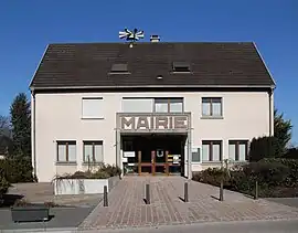 The town hall in Roggenhouse | |
.svg.png.webp) Coat of arms | |
Location of Roggenhouse | |
 Roggenhouse 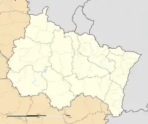 Roggenhouse | |
| Coordinates: 47°53′26″N 7°28′18″E / 47.8906°N 7.4717°E | |
| Country | France |
| Region | Grand Est |
| Department | Haut-Rhin |
| Arrondissement | Colmar-Ribeauvillé |
| Canton | Ensisheim |
| Government | |
| • Mayor (2020–2026) | Vincent Naegelen[1] |
| Area 1 | 6.45 km2 (2.49 sq mi) |
| Population | 461 |
| • Density | 71/km2 (190/sq mi) |
| Time zone | UTC+01:00 (CET) |
| • Summer (DST) | UTC+02:00 (CEST) |
| INSEE/Postal code | 68281 /68740 |
| Elevation | 213–219 m (699–719 ft) (avg. 215 m or 705 ft) |
| 1 French Land Register data, which excludes lakes, ponds, glaciers > 1 km2 (0.386 sq mi or 247 acres) and river estuaries. | |
Roggenhouse (French pronunciation: [ʁɔɡənuz] ⓘ; German: Roggenhausen) is a commune in the Haut-Rhin department in Grand Est in north-eastern France.[3]
See also
References
- ↑ "Répertoire national des élus: les maires". data.gouv.fr, Plateforme ouverte des données publiques françaises (in French). 9 August 2021.
- ↑ "Populations légales 2021". The National Institute of Statistics and Economic Studies. 28 December 2023.
- ↑ Commune de Roggenhouse (68281), INSEE
Wikimedia Commons has media related to Roggenhouse.
This article is issued from Wikipedia. The text is licensed under Creative Commons - Attribution - Sharealike. Additional terms may apply for the media files.