Rong Kwang
ร้องกวาง | |
|---|---|
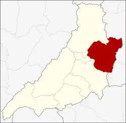 District location in Phrae province | |
| Coordinates: 18°20′23″N 100°19′3″E / 18.33972°N 100.31750°E | |
| Country | Thailand |
| Province | Phrae |
| Seat | Rong Kwang |
| Area | |
| • Total | 631.4 km2 (243.8 sq mi) |
| Population (2008) | |
| • Total | 51,016 |
| • Density | 81.4/km2 (211/sq mi) |
| Time zone | UTC+7 (ICT) |
| Postal code | 54140 |
| Geocode | 5402 |
Rong Kwang (Thai: ร้องกวาง, pronounced [rɔ́ːŋ kwāːŋ]) is a district (amphoe) in the northeastern part of Phrae province, northern Thailand.
Geography
Neighboring districts are (from the southwest clockwise): Mueang Phrae, Nong Muang Khai, and Song of Phrae Province; Wiang Sa, Na Noi, and Na Muen of Nan province.
History
The minor district (king amphoe) Rong Kwang was upgraded to a full district in 1909.[1]
Administration
The district is divided into 11 sub-districts (tambons), which are further subdivided into 93 villages (mubans). The township (thesaban tambon) Rong Kwang covers parts of tambon Rong Kwang and parts of tambons Rong Khem and Thung Si. There are a further nine tambon administrative organizations (TAO).
| No. | Name | Thai | Villages | Pop.[2] |
|---|---|---|---|---|
| 1. | Rong Kwang | ร้องกวาง | 14 | 6,996 |
| 4. | Rong Khem | ร้องเข็ม | 11 | 5,135 |
| 5. | Nam Lao | น้ำเลา | 10 | 5,578 |
| 6. | Ban Wiang | บ้านเวียง | 14 | 7,591 |
| 7. | Thung Si | ทุ่งศรี | 5 | 3,320 |
| 8. | Mae Yang Tan | แม่ยางตาล | 10 | 5,238 |
| 9. | Mae Yang Ho | แม่ยางฮ่อ | 5 | 3,128 |
| 10. | Phai Thon | ไผ่โทน | 9 | 4,192 |
| 13. | Huai Rong | ห้วยโรง | 8 | 3,042 |
| 14. | Mae Sai | แม่ทราย | 4 | 2,851 |
| 15. | Mae Yang Rong | แม่ยางร้อง | 6 | 3,945 |
Missing numbers are tambons which now form Nong Muang Khai District.
References
- ↑ ประกาศกระทรวงมหาดไทย ประกาศตั้งอำเภอเมืองสาแลอำเภอร้องกวาง ในมณฑลพายัพ (PDF). Royal Gazette (in Thai). 26 (ง): 1289. 1909-09-12. Archived from the original (PDF) on January 27, 2012.
- ↑ "Population statistics 2008". Department of Provincial Administration.
External links
- amphoe.com (Thai)
.svg.png.webp)