| Rugged Mountain | |
|---|---|
 NW aspect in February | |
| Highest point | |
| Elevation | 1,861 m (6,106 ft)[1] |
| Prominence | 1,571 m (5,154 ft)[1] |
| Parent peak | Victoria Peak (2169 m)[1] |
| Listing | |
| Coordinates | 50°01′30″N 126°40′40″W / 50.02500°N 126.67778°W[2] |
| Geography | |
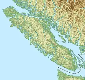
 Rugged Mountain Location in British Columbia  Rugged Mountain Rugged Mountain (British Columbia) | |
| Location | Vancouver Island, British Columbia, Canada |
| District | Rupert Land District |
| Parent range | Haihte Range Vancouver Island Ranges |
| Topo map | NTS 92L2 Woss Lake[2] |
| Climbing | |
| First ascent | 1959 George Lepore[1] |
Rugged Mountain is the apex of the Haihte Range on Vancouver Island, British Columbia. From it, several glaciers, Nootka Sound, Woss Lake and the Tlupana Range are in view.
History
The first attempt at an ascent of Rugged Mountain occurs when Captain Hamilton Moffat, officer in charge of the Hudson's Bay Company post at Fort Rupert, near present-day Port Hardy, began a first exploration inland. On July 5, 1852 he gave up his attempt. He named the mountain Ben Lomand. This was the first recorded attempt to climb any of the major peaks of the Vancouver Island Ranges.[3]
The first successful ascent of Rugged Mountain was completed in 1959 by George Lepore and Chuck Smitson.[4]
References
- 1 2 3 4 "Rugged Mountain". Bivouac.com. Retrieved 2010-06-09.
- 1 2 "Rugged Mountain". BC Geographical Names. Retrieved 2021-06-03.
- ↑ Elms, p 19-20.
- ↑ Stone, p 424
- Sources
- Stone, Philip (2003). Island Alpine, A Guide to the Mountains of Strathcona Park and Vancouver Island. Wild Isle Publications: Heriot Bay, BC. ISBN 0-9680766-5-3.
- Elms, Lindsay (1996). Beyond Nootka, A Historical Perspective of Vancouver Island Mountains. Misthorn Press: Courtenay, BC. ISBN 0-9680159-0-5.
External links
- "Vancouver Island Ranges".Canadian Mountain Encyclopedia. Bivouac.com
This article is issued from Wikipedia. The text is licensed under Creative Commons - Attribution - Sharealike. Additional terms may apply for the media files.