Sabu Raijua Regency
Kabupaten Sabu Raijua | |
|---|---|
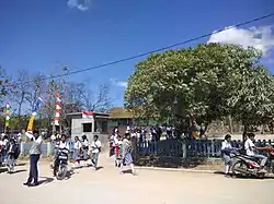 A school in West Savu | |
 Coat of arms | |
 Location within East Nusa Tenggara | |
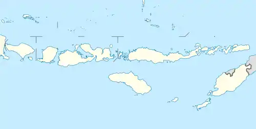 Sabu Raijua Regency Location in Lesser Sunda Islands and Indonesia 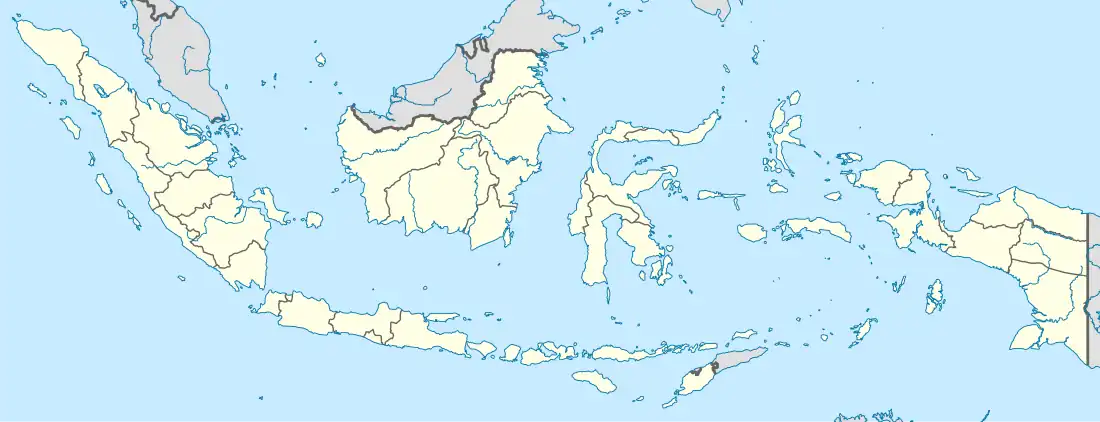 Sabu Raijua Regency Sabu Raijua Regency (Indonesia) | |
| Coordinates: 10°33′46″S 121°47′20″E / 10.5629°S 121.7889°E | |
| Country | |
| Region | Lesser Sunda Islands |
| Province | |
| Capital | Menia, West Savu |
| Government | |
| • Regent | Nikodemus Rihi Heke |
| • Vice Regent | vacant |
| Area | |
| • Total | 177.44 sq mi (459.58 km2) |
| Population (mid 2022 estimate) | |
| • Total | 92,792 |
| • Density | 520/sq mi (200/km2) |
| [1] | |
| Area code | (+62) 380 |
| Website | saburaijuakab.go.id |
Sabu Raijua Regency is one of the regencies in the province of East Nusa Tenggara, Indonesia. It comprises the three Savu Islands, lying between Sumba and Rote Island in the Savu Sea, with a land area of 459.58 km2. The regency was established by Indonesia's Minister of Home Affairs, Mardiyanto, on 29 October 2008, when it was partitioned from Kupang Regency. The population was 72,960 at the 2010 census,[2] and 89,327 at the 2020 Census;[3] the official estimate as at mid 2022 was 92,792.[1]
Administration
The regency is divided into six districts (kecamatan), tabulated below with their areas and their populations at the 2010 Census[2] and 2020 Census,[3] together with the official estimates as at mid 2022.[1] Note all districts are on Sabu Island except for Raijua District, which encompasses Rai Jua or Raijua Island (37.27 km2) and uninhabited Rai Dana Island (0.89 km2) The table also includes the location of the district administrative centres, the number of administrative villages in each district (totaling 58 rural desa and 5 urban kelurahan), and its post code.
| Kode Wilayah | Name of District (kecamatan) | English name | Area in km2 | Pop'n Census 2010 | Pop'n Census 2020 | Pop'n Estimate mid 2022 | Admin centre | No. of villages | Post code |
|---|---|---|---|---|---|---|---|---|---|
| 53.20.06 | Raijua | Raijua Island | 38.16 | 7,671 | 8,950 | 9,167 | Ledeunu | 5 (a) | 85393 |
| 53.20.01 | Sabu Barat | West Savu | 185.16 | 26,463 | 33,225 | 34,515 | Seba | 10 (b) | 85395 |
| 53.20.05 | Hawu Mehara | (Southwest Savu) | 62.81 | 15,361 | 18,664 | 19,267 | Tana Jawa | 12 | 85391 |
| 53.20.03 | Sabu Timur | East Savu | 37.21 | 7,453 | 8,937 | 9,641 | Bolou | 18 (c) | 85394 |
| 53.20.04 | Sabu Liae | (South Savu) | 57.62 | 8,847 | 10,718 | 11,058 | Eilogu | 8 | 85396 |
| 53.20.02 | Sabu Tengah | Central Savu | 78.62 | 7,165 | 8,833 | 9,144 | Eimadake | 10 | 85392 |
| Totals | 459.58 | 72,960 | 89,327 | 92,792 | Menia | 63 |
Notes: (a) including 2 kelurahan - Ledeunu and Ledeke. (b) including one kelurahan - Mebba. (c) including 2 kelurahan - Bolou and Limaggu.
References
Regencies and cities of East Nusa Tenggara | ||
|---|---|---|
Capital: Kupang | ||
| Regencies |  | |
| Cities | ||