Sadinja Vas pri Dvoru | |
|---|---|
 | |
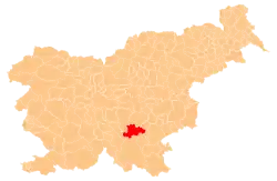
 Sadinja Vas pri Dvoru Location in Slovenia | |
| Coordinates: 45°49′17.63″N 14°57′51.16″E / 45.8215639°N 14.9642111°E | |
| Country | |
| Traditional region | Lower Carniola |
| Statistical region | Southeast Slovenia |
| Municipality | Žužemberk |
| Area | |
| • Total | 2.76 km2 (1.07 sq mi) |
| Elevation | 248.2 m (814.3 ft) |
| Population (2002) | |
| • Total | 161 |
| [1] | |
Sadinja Vas pri Dvoru (pronounced [saˈdiːnja ˈʋaːs pɾi ˈdʋɔːɾu]; Slovene: Sadinja vas pri Dvoru, German: Schöpfendorf[2]) is a village in the Municipality of Žužemberk in southeastern Slovenia. It lies on the left bank of the Krka River just off the regional road from Žužemberk to Dvor. The area is part of the historical region of Lower Carniola. The municipality is now included in the Southeast Slovenia Statistical Region.[3]
Name
The name of the settlement was recorded as Schependorf in 1286, Scheffendorff in 1416, and Schephendorf and Schephndorf in 1454.[4] The Slovene name developed from *Sodinja vas 'village belonging to a sodij (village judge)', which is also confirmed by the Middle High German equivalent with schep(f)e 'member of the judicial bench' who assisted the lord of the estate in judicial matters.[5] The name of the settlement was changed from Sadinja vas to Sadinja vas pri Dvoru in 1955.[6]
References
- ↑ Statistical Office of the Republic of Slovenia
- ↑ Leksikon občin kraljestev in dežel zastopanih v državnem zboru, vol. 6: Kranjsko. Vienna: C. Kr. Dvorna in Državna Tiskarna. 1906. p. 172.
- ↑ Žužemberk municipal site
- ↑ "Sadinja vas pri Dvoru". Slovenska historična topografija. ZRC SAZU Zgodovinski inštitut Milka Kosa. Retrieved October 10, 2023.
- ↑ Snoj, Marko (2009). Etimološki slovar slovenskih zemljepisnih imen. Ljubljana: Modrijan. pp. 365–366.
- ↑ Spremembe naselij 1948–95. 1996. Database. Ljubljana: Geografski inštitut ZRC SAZU, DZS.
External links
 Media related to Sadinja Vas pri Dvoru at Wikimedia Commons
- Sadinja Vas pri Dvoru on Geopedia
