Saint-Alfred | |
|---|---|
 | |
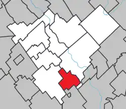 Location within Beauce-Centre RCM. | |
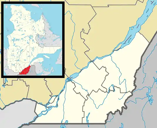 Saint-Alfred Location in southern Quebec. | |
| Coordinates: 46°09′N 70°50′W / 46.150°N 70.833°W[1] | |
| Country | |
| Province | |
| Region | Chaudière-Appalaches |
| RCM | Beauce-Centre |
| Constituted | January 1, 1950 |
| Government | |
| • Mayor | Jean-Roch Veilleux |
| • Federal riding | Beauce |
| • Prov. riding | Beauce-Nord |
| Area | |
| • Total | 43.90 km2 (16.95 sq mi) |
| • Land | 43.49 km2 (16.79 sq mi) |
| Population (2021)[3] | |
| • Total | 519 |
| • Density | 11.9/km2 (31/sq mi) |
| • Pop 2016-2021 | |
| • Dwellings | 241 |
| Time zone | UTC−5 (EST) |
| • Summer (DST) | UTC−4 (EDT) |
| Postal code(s) | |
| Area code(s) | 418 and 581 |
| Highways | |
| Website | www |
Saint-Alfred is a municipality in the Municipalité régionale de comté Beauce-Centre in Quebec, Canada. It is part of the Chaudière-Appalaches region and the population is 519 as of 2021. It is named after Alfred the Great and as a tribute to Joseph-Alfred Langlois, Bishop of Valleyfield.
References
- ↑ "Banque de noms de lieux du Québec: Reference number 55539". toponymie.gouv.qc.ca (in French). Commission de toponymie du Québec.
- 1 2 "Répertoire des municipalités: Geographic code 27015". www.mamh.gouv.qc.ca (in French). Ministère des Affaires municipales et de l'Habitation.
- 1 2 "Profile table, Census Profile, 2021 Census of Population - Saint-Alfred, Municipalité (MÉ) [Census subdivision], Quebec". 9 February 2022.
- Commission de toponymie du Québec
- Ministère des Affaires municipales, des Régions et de l'Occupation du territoire
Places adjacent to Saint-Alfred, Quebec | ||||||||||||||||
|---|---|---|---|---|---|---|---|---|---|---|---|---|---|---|---|---|
| ||||||||||||||||
| Cities & Towns | |
|---|---|
| Municipalities | |
| Parishes | |
| Villages | |
| |
This article is issued from Wikipedia. The text is licensed under Creative Commons - Attribution - Sharealike. Additional terms may apply for the media files.