Saint-Côme | |
|---|---|
Municipality | |
 | |
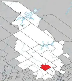 Location within Matawinie RCM | |
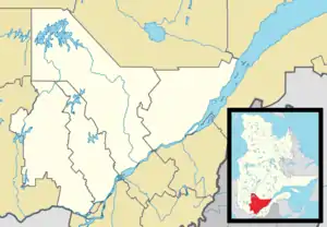 Saint-Côme Location in central Quebec | |
| Coordinates: 46°16′N 73°47′W / 46.27°N 73.78°W[1] | |
| Country | |
| Province | |
| Region | Lanaudière |
| RCM | Matawinie |
| Constituted | January 1, 1873 |
| Government | |
| • Mayor | Martin Bordeleau (since 2013) |
| • Federal riding | Joliette |
| • Prov. riding | Berthier |
| Area | |
| • Total | 169.30 km2 (65.37 sq mi) |
| • Land | 164.89 km2 (63.66 sq mi) |
| Population (2021)[3] | |
| • Total | 2,583 |
| • Density | 15.7/km2 (41/sq mi) |
| • Pop 2016-2021 | |
| • Dwellings | 2,365 |
| Time zone | UTC−5 (EST) |
| • Summer (DST) | UTC−4 (EDT) |
| Postal code(s) | |
| Area code(s) | 450 and 579 |
| Highways | |
| Website | www |
Saint-Côme (French pronunciation: [sɛ̃ kom]) is a municipality in the Lanaudière region of Quebec, Canada, part of the Matawinie Regional County Municipality.
Demographics
Population
| Year | Pop. | ±% |
|---|---|---|
| 1991 | 1,710 | — |
| 1996 | 1,921 | +12.3% |
| 2001 | 1,923 | +0.1% |
| 2006 | 2,161 | +12.4% |
| 2011 | 2,198 | +1.7% |
| 2016 | 2,193 | −0.2% |
| 2021 | 2,583 | +17.8% |
Private dwellings occupied by usual residents: 1319 (total dwellings: 2365)
Language
Mother tongue:[5]
- English as first language: 1.4%
- French as first language: 96.7%
- English and French as first language: 0.4%
- Other as first language: 1.6%
Education
The Commission scolaire des Samares operates francophone public schools, including:
- École primaire de Saint-Côme[6]
The Sir Wilfrid Laurier School Board operates anglophone public schools, including:
- Joliette Elementary School in Saint-Charles-Borromée[7]
- Joliette High School in Joliette[8]
See also
References
- ↑ "Banque de noms de lieux du Québec: Reference number 55850". toponymie.gouv.qc.ca (in French). Commission de toponymie du Québec.
- 1 2 "Répertoire des municipalités: Geographic code 62065". www.mamh.gouv.qc.ca (in French). Ministère des Affaires municipales et de l'Habitation.
- 1 2 "Data table, Census Profile, 2021 Census of Population - Saint-Côme, Municipalité (MÉ) [Census subdivision], Quebec". 9 February 2022.
- ↑ Statistics Canada: 1996, 2001, 2006, 2011, 2016, 2021 census
- ↑ Statistics Canada 2021 Census - Saint-Côme community profile
- ↑ "de Saint-Côme." Commission scolaire des Samares. Retrieved on September 20, 2017.
- ↑ "JOLIETTE ELEMENTARY ZONE." Sir Wilfrid Laurier School Board. Retrieved on September 17, 2017.
- ↑ "Joliette High School Zone Sec 1-5." Sir Wilfrid Laurier School Board. Retrieved on September 5, 2017.
External links
 Media related to Saint-Côme, Quebec at Wikimedia Commons
Adjacent Municipal Subdivisions | |
|---|---|
| Municipalities | |
|---|---|
| Parishes | |
| Unorganized Territories | |
| |
This article is issued from Wikipedia. The text is licensed under Creative Commons - Attribution - Sharealike. Additional terms may apply for the media files.