Saint-François-Xavier | |||||||||||
|---|---|---|---|---|---|---|---|---|---|---|---|
| Paris Métro station | |||||||||||
_-_2022-07-02_-_1.jpg.webp) MF 77 at Saint-François-Xavier | |||||||||||
| General information | |||||||||||
| Location | 7th arrondissement of Paris Île-de-France France | ||||||||||
| Coordinates | 48°51′07″N 2°18′52″E / 48.851951°N 2.314475°E | ||||||||||
| Owned by | RATP | ||||||||||
| Operated by | RATP | ||||||||||
| Line(s) | |||||||||||
| Platforms | 2 (2 side platforms) | ||||||||||
| Tracks | 2 | ||||||||||
| Construction | |||||||||||
| Accessible | no | ||||||||||
| Other information | |||||||||||
| Station code | 0206 | ||||||||||
| Fare zone | 1 | ||||||||||
| History | |||||||||||
| Opened | 30 December 1923 | ||||||||||
| Passengers | |||||||||||
| 1,213,378 (2021) | |||||||||||
| Services | |||||||||||
| |||||||||||
| Location | |||||||||||
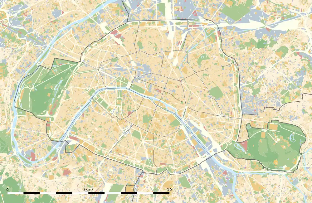
 Saint-François-Xavier Location within Paris | |||||||||||
Saint-François-Xavier (French pronunciation: [sɛ̃ fʁɑ̃swa ɡzavje]) is a station on line 13 of the Paris Métro in the 7th arrondissement. It is named after the nearby Église Saint-François-Xavier, a church dedicated to Saint Francis Xavier (1506–1562), co-founder of the Society of Jesus.
History
The station opened on 20 December 1923 as part of the original section of line 10 between Invalides and Croix Rouge (a ghost station east of Sèvres - Babylone; it was closed permanently during World War II). On 27 July 1937, as part of a reconfiguration of lines 8, 10, and the old line 14, the section of line 10 between Invalides and Duroc was transferred to become the first section of old line 14, linking Invalides and Porte de Vanves. On 9 November 1976, the old line 14 was merged with line 13 when it was extended from its former southern terminus at Saint-Lazare.
The station's corridors and lighting were renovated as part of the "Renouveau du métro" programme by the RATP on during the 2000s.[1] In 2012, platform screen doors were installed on the platforms, together with eleven other stations on the line in an attempt to increase the average speed of trains and reduce track-related incidents due to the line's heavy traffic.
In 2019, the station was used by 1,701,996 passengers, making it the 266th busiest of the Métro network out of 302 stations.[2]
In 2020, the station was used by 812,792 passengers amidst the COVID-19 pandemic, making it the 265th busiest of the Métro network out of 305 stations.[3]
In 2021, the station was used by 1,213,378 passengers, making it the 260th busiest of the Métro network out of 305 stations.[4]
Passenger services
Access
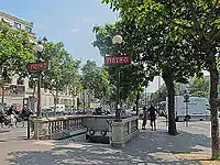
The station has a single access at Place André-Tardieu. It was designed by Joseph Marie Cassien-Bernard in a neo-classical style and his name is engraved on it. It is installed with two Dervaux lampposts, a rare occurrence on the network where most accesses only have a single one installed, a feature it shares with Mairie des Lilas on line 11.
Station layout
| Street level | ||
| B1 | Mezzanine | |
| Platform level | Side platform, doors will open on the right | |
| Northbound | ← | |
| Southbound | | |
| Side platform, doors will open on the right | ||
Platforms
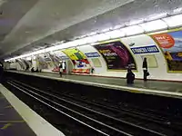
The station has a standard configuration with 2 tracks surrounded by 2 side platforms.
Other connections
The station is also served by lines 82, 86, and 92 of the RATP bus network.
Nearby
- Église Saint-François-Xavier
- Headquarters of the Regional Council of Île-de-France
- La Pagode
- Lycée et collège Victor-Duruy
- Ministry of the Overseas
- Embassy of the Netherlands
Gallery
 Access at Place André-Tardieu
 Saint-François-Xavier before the installation of platform screen doors
References
- ↑ "Le Renouveau du Métro". www.symbioz.net (in French). Retrieved 26 December 2022.
- ↑ "Trafic annuel entrant par station du réseau ferré 2019". dataratp2.opendatasoft.com (in French). Archived from the original on 21 January 2022. Retrieved 26 December 2022.
- ↑ "Trafic annuel entrant par station du réseau ferré 2020". data.ratp.fr (in French). Archived from the original on 21 January 2022. Retrieved 26 December 2022.
- ↑ "Trafic annuel entrant par station du réseau ferré 2021". data.ratp.fr (in French). Retrieved 26 December 2022.
- Roland, Gérard (2003). Stations de métro. D’Abbesses à Wagram. Éditions Bonneton.