Saint-Timothée | |
|---|---|
Former municipality | |
 | |
| Coordinates: 45°17′24″N 74°02′28″W / 45.29000°N 74.04111°W | |
| Country | Canada |
| Province | Quebec |
| Region | Montérégie |
| RCM | Beauharnois-Salaberry |
| Municipality | Salaberry-de-Valleyfield |
| Merged | Jan 01, 2002 |
| Area | |
| • Land | 73.05 km2 (28.20 sq mi) |
| Population (2006)[1] | |
| • Total | 8,564 |
| • Density | 117.2/km2 (304/sq mi) |
| • Pop 2001-2006 | |
| • Dwellings | 3,375 |
| Time zone | UTC-5 (EST) |
| • Summer (DST) | UTC-4 (EDT) |
| Area code | 450 |
| Access Routes[2] | |
| + Merged with Salaberry-de-Valleyfield | |
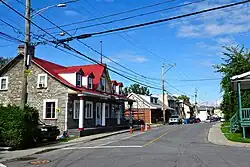
Saint-Timothée is a former municipality located in the Montérégie region of Quebec, Canada, on Île-de-Salaberry in the St. Lawrence River. It occupied the middle third and largest area of the island, which is part of the Hochelaga Archipelago. The municipality is flanked by the cities of Beauharnois to the east, and to the west by Salaberry-de-Valleyfield, which Saint-Timothée was merged with on January 1, 2002.
See also
References
External links
![]() Media related to Saint-Timothée, Quebec at Wikimedia Commons
Media related to Saint-Timothée, Quebec at Wikimedia Commons
This article is issued from Wikipedia. The text is licensed under Creative Commons - Attribution - Sharealike. Additional terms may apply for the media files.