Saint-Victour | |
|---|---|
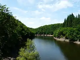 The Diège dam, upstream of Chaumettes | |
.svg.png.webp) Coat of arms | |
Location of Saint-Victour | |
 Saint-Victour 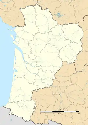 Saint-Victour | |
| Coordinates: 45°27′55″N 2°22′51″E / 45.4653°N 2.3808°E | |
| Country | France |
| Region | Nouvelle-Aquitaine |
| Department | Corrèze |
| Arrondissement | Ussel |
| Canton | Haute-Dordogne |
| Intercommunality | Haute-Corrèze Communauté |
| Government | |
| • Mayor (2020–2026) | Jean-Marc Bodin[1] |
| Area 1 | 14.79 km2 (5.71 sq mi) |
| Population | 194 |
| • Density | 13/km2 (34/sq mi) |
| Time zone | UTC+01:00 (CET) |
| • Summer (DST) | UTC+02:00 (CEST) |
| INSEE/Postal code | 19247 /19200 |
| Elevation | 513–737 m (1,683–2,418 ft) (avg. 550 m or 1,800 ft) |
| 1 French Land Register data, which excludes lakes, ponds, glaciers > 1 km2 (0.386 sq mi or 247 acres) and river estuaries. | |
Saint-Victour (French pronunciation: [sɛ̃ viktuʁ]; Occitan: Sent Victor) is a commune in the Corrèze department in central France.
Geography
The river Diège forms all of the commune's western and southwestern boundaries.
Population
| Year | Pop. | ±% |
|---|---|---|
| 1962 | 254 | — |
| 1968 | 261 | +2.8% |
| 1975 | 211 | −19.2% |
| 1982 | 183 | −13.3% |
| 1990 | 142 | −22.4% |
| 1999 | 171 | +20.4% |
| 2008 | 179 | +4.7% |
See also
References
- ↑ "Répertoire national des élus: les maires" (in French). data.gouv.fr, Plateforme ouverte des données publiques françaises. 13 September 2022.
- ↑ "Populations légales 2021". The National Institute of Statistics and Economic Studies. 28 December 2023.
Wikimedia Commons has media related to Saint-Victour.
This article is issued from Wikipedia. The text is licensed under Creative Commons - Attribution - Sharealike. Additional terms may apply for the media files.