| Salair National Park | |
|---|---|
| (Russian: Салаир) | |
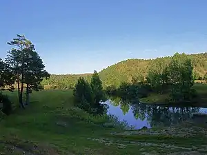
 Southern Salair Ridge in distance, from Soltonsky District | |
 Location of Park | |
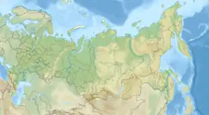
| Location | Altai Republic |
| Nearest city | Barnaul |
| Coordinates | 53°30′N 86°24′E / 53.5°N 86.4°E |
| Area | 161,221 hectares (398,386 acres; 1,612 km2; 622 sq mi) |
| Established | December 2020 |
| Governing body | FGBU "Salair" |
| Website | http://www.tigirek.ru/en/node/1653 |
Salair National Park (Russian: Национальный парк «Салаир») is located on the west slope of the Salair Ridge, which separates Altai Krai (west side) from Kemerovo Oblast (east side). The low mountains are covered with coniferous forest, while the non-park surroundings to the west are steppe and forest steppe that has mostly been converted to agriculture.[1] Because of its warm, humid summers, scientists have referred to Salair as the "rainforest of Siberia", with resulting high biodiversity and relict plants preserved from the pre-glacial period. The park was officially created in 2020;[2] it is located in the districts of Zarinsk, Togulsky, Yeltsovsky and Soltonsky of Altai Krai.
Topography
In aspect, the Salair resemble gentle hills: the highest point in the park is Mount Kivda ((621 metres (2,037 ft)). The terrain is marked by a highly networked system of ravines and valleys.[3] The Salair Ridge is a low northern extension of the Altai Mountains.
Ecoregion and climate
The Salair ridge forms a northwestern extension of the Sayan montane conifer forests ecoregion. It is closely surrounded at lower altitudes on the east and west by the Western Siberian hemiboreal forests ecoregion.[4]
The climate of the park is Humid continental climate, warm summer (Köppen climate classification (Dfb)). This climate is characterized by large seasonal temperature differentials and a warm summer (at least four months averaging over 10 °C (50 °F), but no month averaging over 22 °C (72 °F).[5][6]
| Barnaul, Altai Krai | ||||||||||||||||||||||||||||||||||||||||||||||||||||||||||||
|---|---|---|---|---|---|---|---|---|---|---|---|---|---|---|---|---|---|---|---|---|---|---|---|---|---|---|---|---|---|---|---|---|---|---|---|---|---|---|---|---|---|---|---|---|---|---|---|---|---|---|---|---|---|---|---|---|---|---|---|---|
| Climate chart (explanation) | ||||||||||||||||||||||||||||||||||||||||||||||||||||||||||||
| ||||||||||||||||||||||||||||||||||||||||||||||||||||||||||||
| ||||||||||||||||||||||||||||||||||||||||||||||||||||||||||||

Plants and animals
The park is covered with "dark taiga" coniferous forest: stands of Pinus sibirica (Siberian pine), Picea obovata (Siberian spruce), Abies sibirica (Siberian fir), and stands of Tilia sibirica L. (Siberian linden), with vertically developed shrub and grass layers. There are occasional stands of old-growth cedar and the only stand of indigenous Populus tremula (Quaking aspen) in Siberia. Individual Siberian pines reach 800 years old. Present on the forest floor are Asperula odorata, Asarum europaeum, Sanicula europaea, and Brachypodium sylvaticum[3] There are tall grasses and meadow steppe terrain at lower altitude and in clearings.
Mammals in the park include elk, red deer, roe deer, marmot, American mink, and beaver.
See also
References
- ↑ "Salair National Park" (in Russian). Salair National Park. Retrieved December 9, 2021.
- ↑ "On the creation of the Salair National Park" (in Russian). Russian Federation. Retrieved December 9, 2021.
- 1 2 "Rare Plants and Plant Communities of the Projected "Togul" [Now 'Salair'] National Park (Altai Region)". BioConferences.org. Retrieved December 16, 2021.
- ↑ "Map of Ecoregions 2017". Resolve, using WWF data. Retrieved September 14, 2019.
- ↑ Kottek, M., J. Grieser, C. Beck, B. Rudolf, and F. Rubel, 2006. "World Map of Koppen-Geiger Climate Classification Updated" (PDF). Gebrüder Borntraeger 2006. Retrieved September 14, 2019.
{{cite web}}: CS1 maint: multiple names: authors list (link) CS1 maint: numeric names: authors list (link) - ↑ "Dataset - Koppen climate classifications". World Bank. Retrieved September 14, 2019.
