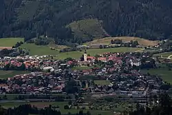
Sankt Lorenzen im Mürztal | |
|---|---|
 | |
 Sankt Lorenzen im Mürztal Location within Austria | |
| Coordinates: 47°28′48″N 15°22′15″E / 47.48000°N 15.37083°E | |
| Country | Austria |
| State | Styria |
| District | Bruck-Mürzzuschlag |
| Government | |
| • Mayor | Wilhelm Weberhofer (ÖVP) |
| Area | |
| • Total | 38.08 km2 (14.70 sq mi) |
| Elevation | 500−1,366 m (−3,982 ft) |
| Population (2018-01-01)[2] | |
| • Total | 3,626 |
| • Density | 95/km2 (250/sq mi) |
| Time zone | UTC+1 (CET) |
| • Summer (DST) | UTC+2 (CEST) |
| Postal code | 8642 |
| Area code | 03864 |
| Vehicle registration | BM |
| Website | stlorenzenimmuerztal. riskommunal.net/ |
Sankt Lorenzen im Mürztal is a municipality with 3674 inhabitants (as of January 1, 2021) in the judicial district of Bruck an der Mur and in the political district of Bruck-Mürzzuschlag in Styria, Austria.
Geography
The centre of Sankt Lorenzen is at an altitude of 560 m above sea level. A., the highest point in the municipal area is the Töllmarkogel in the north at 1366 m above sea level.
Sankt Lorenzen im Mürztal is located northeast of the town of Kapfenberg. Other neighbouring communities are (clockwise) Parschlug, Turnau, Kindberg, Allerheiligen im Mürztal, Mürzhofen and Sankt Marein im Mürztal.
References
- ↑ "Dauersiedlungsraum der Gemeinden Politischen Bezirke und Bundesländer - Gebietsstand 1.1.2018". Statistics Austria. Retrieved 10 March 2019.
- ↑ "Einwohnerzahl 1.1.2018 nach Gemeinden mit Status, Gebietsstand 1.1.2018". Statistics Austria. Retrieved 9 March 2019.
This article is issued from Wikipedia. The text is licensed under Creative Commons - Attribution - Sharealike. Additional terms may apply for the media files.