Sarıgöl | |
|---|---|
District and municipality | |
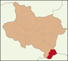
 Map showing Sarıgöl District in Manisa Province | |
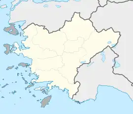
 Sarıgöl Location in Turkey  Sarıgöl Sarıgöl (Turkey Aegean) | |
| Coordinates: 38°14′17″N 28°41′46″E / 38.23806°N 28.69611°E | |
| Country | Turkey |
| Province | Manisa |
| Area | 432 km2 (167 sq mi) |
| Elevation | 220 m (720 ft) |
| Population (2022)[1] | 35,537 |
| • Density | 82/km2 (210/sq mi) |
| Time zone | TRT (UTC+3) |
| Postal code | 45470 |
| Area code | 0236 |
Sarıgöl | |
|---|---|
| Elevation | 194 m (636 ft) |
Sarıgöl is a municipality and district of Manisa Province, Turkey.[2] Its area is 432 km2,[3] and its population is 35,537 (2022).[1] The town lies at an elevation of 220 m (722 ft).
History
Sarıgöl is a small town located between the provinces of Denizli and Manisa. According to some historians, it has been an important city throughout history. There was an ancient city called Callatebus (Ancient Greek: Καλλάτηβος) in the vicinity of today's Sarıgöl. The city of Kallatebos (Callatebus) was mentioned by Herodotus in his Histories 7th book's 31st paragraph.[4] The city was between Philadelphia (Alaşehir) and Hierapolis (Pamukkale).
Composition
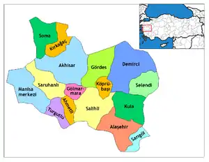
There are 35 neighbourhoods in Sarıgöl District:[5]
- Afşar
- Ahmetağa
- Alemşahlı
- Aşağıkoçaklar
- Ayan
- Bağlıca
- Bahadırlar
- Baharlar
- Bereketli
- Beyharmanı
- Çanakçı
- Çavuşlar
- Çimentepe
- Cumhuriyet
- Dadağlı
- Dindarlı
- Doğuşlar
- Emcelli
- Güneydamları
- Günyaka
- Kahramanlar
- Karacaali
- Kızılçukur
- Konak
- Mimarsinan
- Özpınar
- Selimiye
- Şeyhdavutlar
- Sığırtmaçlı
- Siteler
- Tırazlar
- Yeniköy
- Yeşiltepe
- Yukarıkoçaklar
- Ziyanlar
References
- 1 2 "Address-based population registration system (ADNKS) results dated 31 December 2022, Favorite Reports" (XLS). TÜİK. Retrieved 12 July 2023.
- ↑ Büyükşehir İlçe Belediyesi, Turkey Civil Administration Departments Inventory. Retrieved 12 July 2023.
- ↑ "İl ve İlçe Yüz ölçümleri". General Directorate of Mapping. Retrieved 12 July 2023.
- ↑
 Smith, William, ed. (1854–1857). "Callatebus". Dictionary of Greek and Roman Geography. London: John Murray.
 - ↑ Mahalle, Turkey Civil Administration Departments Inventory. Retrieved 19 September 2023.
External links
- District governor's official website (in Turkish)
- District municipality's official website (in Turkish)
- Road map of Sarıgöl and environs
- Various images of Sarıgöl
This article is issued from Wikipedia. The text is licensed under Creative Commons - Attribution - Sharealike. Additional terms may apply for the media files.
