Highway 350 | ||||
|---|---|---|---|---|
| Route information | ||||
| Maintained by Ministry of Highways and Infrastructure | ||||
| Length | 16.4 km[1] (10.2 mi) | |||
| Major junctions | ||||
| South end | ||||
| North end | ||||
| Location | ||||
| Country | Canada | |||
| Province | Saskatchewan | |||
| Rural municipalities | Cambria | |||
| Highway system | ||||
|
| ||||
| ||||
.svg.png.webp)
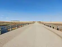
Bridge along Highway 350 over Long Creek in Saskatchewan
Highway 350 is a provincial highway in the Canadian province of Saskatchewan. It runs from Highway 18 near Torquay to North Dakota Highway 42 at the U.S. border at the Port of Torquay. It is about 16 kilometres (9.9 mi) long.[1]
Major intersections
From south to north:[2]
| Rural municipality | Location | km[1] | mi | Destinations | Notes |
|---|---|---|---|---|---|
| Cambria No. 6 | Port of Torquay | 0.0 | 0.0 | Continuation into North Dakota | |
| Canada–United States border at Ambrose–Torquay Border Crossing | |||||
| Torquay | 16.4 | 10.2 | |||
| 1.000 mi = 1.609 km; 1.000 km = 0.621 mi | |||||
See also
References
- 1 2 3 Google (6 February 2018). "Highway 350 in Saskatchewan" (Map). Google Maps. Google. Retrieved 6 February 2018.
- ↑ MapArt (2007). Saskatchewan Road Atlas (Map) (2007 ed.). 1:540,000. Oshawa, ON: Peter Heiler Ltd. p. 51. ISBN 1-55368-020-0.
External links
 Media related to Saskatchewan Highway 350 at Wikimedia Commons
This article is issued from Wikipedia. The text is licensed under Creative Commons - Attribution - Sharealike. Additional terms may apply for the media files.