| Schwülme | |
|---|---|
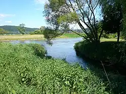
 Confluence of the Schwülme and Weser near Lippoldsberg | |
| Location | |
| Country | Germany |
| States | Hesse and Lower Saxony |
| Reference no. | DE: 436 |
| Physical characteristics | |
| Source | |
| • location | West of Hettensen (part of Hardegsen) |
| • coordinates | 51°37′34″N 9°44′57″E / 51.6261556°N 9.7492250°E |
| • elevation | ca. 332 m above sea level (NN) |
| Mouth | |
• location | Near Lippoldsberg into the Weser |
• coordinates | 51°37′39″N 9°33′14″E / 51.627398°N 9.553830°E |
• elevation | ca. 106 m above sea level (NN) |
| Length | 32.0 km (19.9 mi)[1] |
| Basin size | 289.753 km2 (111.874 sq mi) [2] |
| Basin features | |
| Progression | Weser→ North Sea |
The Schwülme is a river of Lower Saxony and Hesse, Germany. It is 29 kilometres (18 mi) long and a right-hand and eastern tributary of the Weser.
See also
References
- ↑ Environmental map service of Lower Saxony (Umweltkartendienst des Niedersächsischen Ministeriums für Umwelt, Energie und Klimaschutz)
- ↑ Water map service of the Hessian Ministry for the Environment, Energy, Agriculture and Consumer Protection (Hessisches Ministerium für Umwelt, Energie, Landwirtschaft und Verbraucherschutz)
This article is issued from Wikipedia. The text is licensed under Creative Commons - Attribution - Sharealike. Additional terms may apply for the media files.