| Sierra de Santa Cruz | |
|---|---|
 Sierra de Santa Cruz | |
| Highest point | |
| Elevation | 1,100 m (3,600 ft) |
| Coordinates | 15°40′52″N 89°19′37″W / 15.68111°N 89.32694°W |
| Dimensions | |
| Length | 55 km (34 mi) south-west to north-east |
| Width | 13 km (8.1 mi) |
| Geography | |
| Country | Guatemala |
| Department | Izabal |
| Geology | |
| Age of rock | Mesozoic (Cretaceous) |
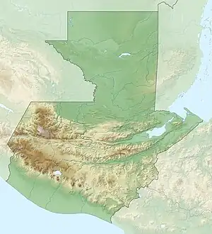
The Sierra de Santa Cruz is a small mountain range in eastern Guatemala. It is situated north of Lake Izabal, in the department of Izabal. The mountain range has a south-west to north-east orientation, and is approximately 55 km long and 13 km wide.[1] Its highest peaks have an altitude of approximately 1100 m (15°40′52″N 89°19′37″W / 15.68122°N 89.32692°W).
Fauna
Craugastor trachydermus, a species of frog in the family Craugastoridae, is endemic to Guatemala and only known from its type locality, Xiacam in the Sierra de Santa Cruz.[2] It is critically endangered.[3]
See also
References
- ↑ Williams, M. Dean (1975). "Emplacement of Sierra de Santa Cruz, Eastern Guatemala: Geologic Notes". AAPG Bulletin. 59. doi:10.1306/83D91F65-16C7-11D7-8645000102C1865D.
- ↑ Frost, Darrel R. (2017). "Craugastor trachydermus (Campbell, 1994)". Amphibian Species of the World: an Online Reference. Version 6.0. American Museum of Natural History. Retrieved 28 June 2017.
- ↑ Acevedo, M.; Smith, E. (2004). "Craugastor trachydermus". IUCN Red List of Threatened Species. 2004: e.T57013A11566771. doi:10.2305/IUCN.UK.2004.RLTS.T57013A11566771.en.
This article is issued from Wikipedia. The text is licensed under Creative Commons - Attribution - Sharealike. Additional terms may apply for the media files.