| Solitude Range | |
|---|---|
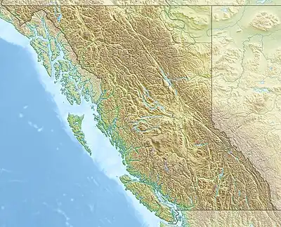 Solitude Range General Extent of the Solitude Range | |
| Highest point | |
| Peak | Mount Stephenson |
| Elevation | 2,037 m (6,683 ft)[1] |
| Prominence | 855 m (2,805 ft)[1][2] |
| Listing | Mountains of British Columbia |
| Coordinates | 55°24′53″N 122°17′55″W / 55.41472°N 122.29861°W[3] |
| Dimensions | |
| Area | 766 km2 (296 sq mi) |
| Geography | |
| Country | Canada |
| Province | British Columbia |
| Parent range | Hart Ranges |
Solitude Range is a subdivision range of the Hart Ranges, of the Northern Rockies in British Columbia, Canada. The boundaries of the Solitude Range generally lie between the Murray Range and Mountain Creek to the west, Le Moray Creek to the east, the Pine River to the north and Mount Merrick to the south.[4]
Several mountains in the range are named after local area Canadian soldiers killed in action during World War II.
Prominent Peaks
| Rank | Mountain Peak | Coordinates | Elevation (m/ft) | Prom. (m/ft) | Isolation | Nearest Higher Neighbor | ||
|---|---|---|---|---|---|---|---|---|
| 1 | Mount Stephenson | 55°24′53″N 122°17′55″W / 55.41472°N 122.29861°W | 6,683
style="text-align:right;" data-sort-value="7002855000000000000"|855 |
2,805 | 22.0 km S | Grant Peak | ||
| 2 | Howling Wolves Peak | 55°19′49″N 122°7′48″W | 6,542
style="text-align:right;" data-sort-value="7002557000000000000"|557 |
1,827 | 14.2 km WNW | Mount Stephenson | ||
| 3 | Mount Gilliland | 55°21′20″N 122°11′55″W / 55.35556°N 122.19861°W | 6,360
style="text-align:right;" data-sort-value="7002516000000000000"|516 |
1,693 | 5.2 km ESE | Howling Wolves Peak | ||
| 4 | Watson Peak | 55°13′41″N 122°5′22″W / 55.22806°N 122.08944°W | 6,309
style="text-align:right;" data-sort-value="7002611000000000000"|611 |
2,005 | 8.5 km W | Unnamed Peak | ||
| 5 | Goodrich Peak | 55°20′53″N 122°4′52″W | 6,194
style="text-align:right;" data-sort-value="7002233000000000000"|233 |
764 | 3.7 km WSW | Howling Wolves Peak | ||
| 6 | Brazion Peak | 55°19′33″N 122°9′41″W | 5,948
style="text-align:right;" data-sort-value="7002264000000000000"|264 |
866 | 1.4 ENE | Howling Wolves Peak | ||
| 7 | Mount Merrick | 55°10′58″N 121°55′38″W / 55.18278°N 121.92722°W | 5,738
style="text-align:right;" data-sort-value="7002294000000000000"|294 |
965 | 9.4 km W | Mount Jilg | ||
| 8 | Mount Le Moray | 55°27′8″N 122°28′39″W | 5,669
style="text-align:right;" data-sort-value="7002348000000000000"|348 |
1,142 | 12.0 km ESE | Unnamed Peak | ||
| 9 | Pyramis Peak | 55°30′60″N 122°26′28″W | 5,653
style="text-align:right;" data-sort-value="7002216000000000000"|216 |
709 | 7.5 km SSW | Mount Le Moray | ||
| 10 | Solitude Mountain | 55°29′22″N 122°36′24″W | 5,164
style="text-align:right;" data-sort-value="7002564000000000000"|564 |
1,850 | 5.9 km SSW | Unnamed Peak | ||
References
- 1 2 "Mount Stephenson". peakvisor.com. Retrieved 2023-07-13.
- ↑ "Mount Stephenson". Bivouac.com. Retrieved 2023-07-13.
- ↑ "Mount Stephenson". BC Geographical Names. Retrieved 2023-07-13.
- ↑ Holland, Stuart S. (1976). Bulletin 48: Landforms of British Columbia--A Physiographic Outline (PDF). K.M MacDonald, Province of British Columbia. Archived from the original (PDF) on 2016-03-04.
- ↑ "Hart Ranges". PeakVisor. Retrieved 2020-05-07.
This article is issued from Wikipedia. The text is licensed under Creative Commons - Attribution - Sharealike. Additional terms may apply for the media files.