Sonha 손하 | |||||||||||
|---|---|---|---|---|---|---|---|---|---|---|---|
 | |||||||||||
| Korean name | |||||||||||
| Hangul | 손하역 | ||||||||||
| Hanja | |||||||||||
| Revised Romanization | Sonha-yeok | ||||||||||
| McCune–Reischauer | Sonha-yŏk | ||||||||||
| General information | |||||||||||
| Location | Kaesŏng-t'ŭkkŭpsi, North Hwanghae North Korea | ||||||||||
| Owned by | Korean State Railway | ||||||||||
| Operated by | Korean State Railway | ||||||||||
| History | |||||||||||
| Opened | 3 April 1906 | ||||||||||
| Rebuilt | 2003 | ||||||||||
| Electrified | No | ||||||||||
| Original company | Chosen Government Railway | ||||||||||
| Services | |||||||||||
| |||||||||||
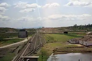
Sonha station is a railway station located in Kaesŏng-t'ŭkkŭpsi, North Hwanghae province, North Korea.[1] It is on located on the P'yŏngbu Line, which was formed from part of the Kyŏngŭi Line to accommodate the shift of the capital from Seoul to P'yŏngyang; though this line physically connects P'yŏngyang to Pusan via Dorasan, in operational reality it ends at Kaesŏng due to the Korean Demilitarized Zone.[1]
History
The station was originally opened by the Chosen Government Railway on 3 April 1906, but was closed after the Korean War. The station, as well as the disused section from Kaesŏng across the DMZ to Dorasan, was rebuilt in 2003, and a special train inaugurating the reopened line ran on 17 May 2007. Regular freight service began between Dorasan and the Kaesŏng Industrial Region,[2] and although passenger service for South Korean workers exists between Dorasan and the Kaesŏng Industrial Area, apart from the inaugural special train, there has been no passenger service to Sonha station. The freight and passenger services have been interrupted several times as a result of political events between North and South that have caused the closure of the industrial district; it was most recently reopened on 16 September 2013 after a five-month shutdown.[3]
References
- 1 2 Kokubu, Hayato, 将軍様の鉄道 (Shōgun-sama no Tetsudō), ISBN 978-4-10-303731-6
- ↑ "First Regular Train Service Crosses Inter-Korean Border". Korea Report. 11 December 2007. Retrieved 9 December 2015.
- ↑ K .J. Kwon (16 September 2013). "North and South Korea reopen Kaesong Industrial Complex". CNN. Retrieved 17 January 2014.
37°57′28″N 126°34′53″E / 37.95778°N 126.58139°E