Southeast Minahasa Regency
Kabupaten Minahasa Tenggara | |
|---|---|
 Coat of arms | |
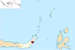 Location in North Sulawesi | |
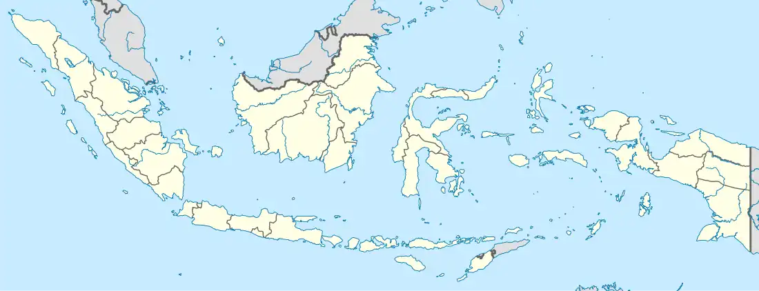 Southeast Minahasa Regency Location in Indonesia | |
| Coordinates: 1°2′5″N 124°48′36″E / 1.03472°N 124.81000°E | |
| Country | Indonesia |
| Province | North Sulawesi |
| Established | 2 January 2007 |
| Inaugurated | 23 May 2007 |
| Capital | Ratahan |
| Government | |
| • Regent | James Sumendap |
| • Vice Regent | Jesaja Legi |
| Area | |
| • Total | 710.83 km2 (274.45 sq mi) |
| Population (mid 2022 estimate)[1] | |
| • Total | 118,023 |
| • Density | 170/km2 (430/sq mi) |
| Time zone | UTC+8 (WITA) |
| Website | mitrakab.go.id |
Southeast Minahasa Regency is a regency in North Sulawesi, Indonesia. It covers an area of 710.83 km2, and had a population of 100,443 at the 2010 Census;[2] this had risen to 116,323 at the 2020 Census,[3] and the official estimate as at mid 2022 was 118,023.[1] It was established as a separate regency from part of the South Minahasa Regency on 2 January 2007.[4] Its administrative centre is at the town of Ratahan; Ratahan is also a language spoken in the Regency.
Administrative Districts
The regency is divided into twelve districts (kecamatan), tabulated below with their areas and their populations at the 2010 Census[2] and the 2020 Census,[3] together with the official estimates as at mid 2022.[1] The table also includes the locations of the district administrative centres, the number of villages in each district (totaling 135 rural desa and 9 urban kelurahan - the latter all in Ratahan District), and its post codes.
| Kode Wilayah | Name of District (kecamatan) | Area in km2 | Pop'n Census 2010 | Pop'n Census 2020 | Pop'n Estimate mid 2022 | Admin centre | No. of villages | Post code |
|---|---|---|---|---|---|---|---|---|
| 71.07.04 | Ratatotok (a) | 104.18 | 12,117 | 14,227 | 14,472 | Ratatotok | 15 | 95999 |
| 71.07.02 | Pusomaen (b) | 53.63 | 8,219 | 9,583 | 9,735 | Tetengesan | 15 | 95997 |
| 71.07.03 | Belang (c) | 75.17 | 15,224 | 17,286 | 17,470 | Belang | 20 | 95992 |
| 71.07.01 | Ratahan | 61.63 | 12,164 | 13,721 | 13,849 | Tosuraya | 11 (d) | 95994 |
| 71.07.11 | Pasan | 49.79 | 6,594 | 7,570 | 7,667 | Liwutung | 11 | 95993 |
| 71.07.12 | Ratahan Timur (East Ratahan) | 63.99 | 5,548 | 6,174 | 6,215 | Wioy | 10 | 95995 |
| 71.07.05 | Tombatu | 67.95 | 9,008 | 10,151 | 10,244 | Betelen | 11 | 95996 |
| 71.07.09 | Tombatu Timur (East Tombatu) | 18.81 | 8,442 | 9,795 | 9,941 | Molompar Dua | 11 | 95990 |
| 71.07.10 | Tombatu Utara (North Tombatu) | 37.17 | 7,674 | 8,992 | 9,143 | Tombatu Dua | 10 | 95991 |
| 71.07.06 | Touluaan | 101.80 | 6,217 | 7,419 | 7,570 | Ranoketang Atas | 10 | 95981 |
| 71.07.07 | Touluaan Selatan (South Touluaan) | 52.76 | 4,079 | 4,878 | 4,980 | Kalait | 10 | 95982 |
| 71.07.08 | Silian Raya | 43.75 | 5,157 | 6,527 | 6,737 | Silian Dua | 10 | 95998 |
| Totals | 730.63 | 100,443 | 116,323 | 118,023 | Ratahan | 144 |
Notes: (a) including 10 offshore islands. (b) including 9 offshore islands. (c) including 5 offshore islands. (d) comprises 9 kelurahan and 2 desa.
Climate
Ratahan, the seat of the regency has a tropical rainforest climate (Af) moderate rainfall in August and September and heavy rainfall in the remaining months.
| Climate data for Ratahan | |||||||||||||
|---|---|---|---|---|---|---|---|---|---|---|---|---|---|
| Month | Jan | Feb | Mar | Apr | May | Jun | Jul | Aug | Sep | Oct | Nov | Dec | Year |
| Mean daily maximum °C (°F) | 27.9 (82.2) |
28.0 (82.4) |
28.2 (82.8) |
29.0 (84.2) |
29.1 (84.4) |
29.0 (84.2) |
28.9 (84.0) |
29.4 (84.9) |
29.8 (85.6) |
29.9 (85.8) |
29.3 (84.7) |
28.4 (83.1) |
28.9 (84.0) |
| Daily mean °C (°F) | 24.2 (75.6) |
24.3 (75.7) |
24.5 (76.1) |
24.8 (76.6) |
25.1 (77.2) |
24.9 (76.8) |
24.8 (76.6) |
24.9 (76.8) |
25.0 (77.0) |
25.0 (77.0) |
25.0 (77.0) |
24.6 (76.3) |
24.8 (76.6) |
| Mean daily minimum °C (°F) | 20.5 (68.9) |
20.6 (69.1) |
20.8 (69.4) |
20.7 (69.3) |
21.1 (70.0) |
20.9 (69.6) |
20.7 (69.3) |
20.5 (68.9) |
20.2 (68.4) |
20.2 (68.4) |
20.7 (69.3) |
20.8 (69.4) |
20.6 (69.2) |
| Average rainfall mm (inches) | 275 (10.8) |
222 (8.7) |
215 (8.5) |
228 (9.0) |
222 (8.7) |
180 (7.1) |
134 (5.3) |
96 (3.8) |
105 (4.1) |
147 (5.8) |
227 (8.9) |
243 (9.6) |
2,294 (90.3) |
| Source: Climate-Data.org[5] | |||||||||||||
References
- 1 2 3 4 Badan Pusat Statistik, Jakarta, 2023, Kabupaten Minahasa Tenggara Dalam Angka 2023 (Katalog-BPS 1102001.7107)
- 1 2 Biro Pusat Statistik, Jakarta, 2011.
- 1 2 Badan Pusat Statistik, Jakarta, 2021.
- ↑ Undang-Undang Republik Indonesia Nomor 9 Tahun 2007 Archived 2012-01-07 at the Wayback Machine
- ↑ "Climate: Ratahan". Climate-Data.org. Retrieved 22 November 2020.
1°02′05″N 124°48′36″E / 1.03472°N 124.81000°E